
Existed: 1933 – present Length 14.8 km | Counties: Edgecombe Constructed 1933 | |
 | ||
west end: NC 42 near Bridgersville east end: NC 42 / NC 43 near Cobbs Crossroads County | ||
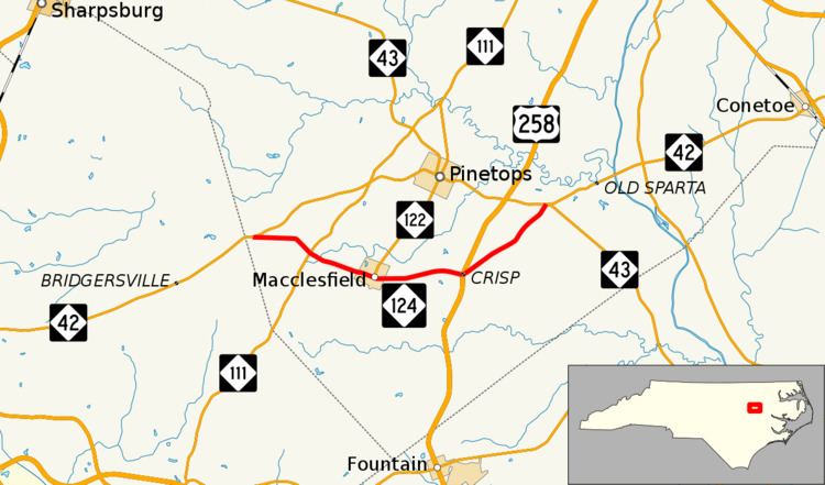
North Carolina Highway 124 (NC 124) is a primary state highway in the U.S. state of North Carolina. It serves to connect the town of Macclesfield and as an alternate to NC 42.
Contents
Map of NC-124, North Carolina, USA
Route Description
NC 24 is a two-lane rural highway that traverses 9.2 miles (14.8 km) through southern Edgecombe County. Beginning at NC 42, near the Wilson county line, NC 24 goes east 3.6 miles (5.8 km) to Macclesfield intersecting NC 111 at Pitt Crossroads. In Macclesfield, it connects with NC 122, where it goes north to Pinetops. Crossing US 258 at Crisp, NC 124 goes northeasterly 3.1 miles (5.0 km) to NC 42/NC 43, where it ends.
History
NC 124 was established in 1933 as a new primary routing from its current western terminus at NC 42 to US 258 in Crisp. In 1964, NC 124 was extended northeast upgrading an existing secondary road (SR 1004) to its current eastern terminus at NC 42/NC 43.
Junction list
The entire route is in Edgecombe County.