
Peak Ruhner Berg Area 5,086 sq. km Parent range HNGD | Elevation 176.8 m (580 ft) Country Germany | |
 | ||
Location | ||
The North Brandenburg Plateaux and Upland (German: Nordbrandenburgische Platten- und Hügelland) is a natural region in the northwest of Brandenburg and, to a lesser extent, the southwest of Mecklenburg-Vorpommern and northeast of Saxony-Anhalt in Germany. It is major unit group no. 77 in the natural regional divisions of Germany. The Brandenburg portion of the North Brandenburg Plateaux and Upland is largely coextensive with the natural region of Prignitz and Ruppin Land (Prignitz und Ruppiner Land) in the structural atlas of the state of Brandenburg.
Contents
Location
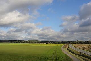
The North Brandenburg Plateaux and Upland is part of the North German Plain. It extends from the Elde depression in the west to the Havel in the middle of North Brandenburg. Its neighbouring natural regions are the Southwest Foreland of the Mecklenburg Lake District to the northwest, the Mecklenburg Lake District to the northeast, the Luchland to the southeast and the Elbe Depression to the southwest.
Description
Several ground moraine plateaux of Saale and Weichselian glacial origin form the heart of the North Brandenburg Plateaux and Upland. In addition there are sandur and valley sand areas as well as the push and terminal moraine ridges of the Ruhn Hills with heights of up to zu 176.8 m above sea level (NHN).
With the exceptionof the Gransee Plateau in the east, the land descends mainly from north to south. Correspondingly the countryside is drained by the Elde, Löcknitz, Stepenitz, Dosse and Rhin and their tributaries into the Rhinluch and the Elbe. Through the centre runs the Kyritz Lake Chain and the chain of elongated tunnel valleys around Lake Ruppin. In the east there are more ground moraines; in the west is Lake Rudow.
Natural regions
The North Brandenburg Plateaux and Upland is divided as follows:
The unit of Ruppin Heaths and Plateaux is seen as only a major unit even though it has four three-figure numbers.