Trisha Shetty (Editor)

Normandie Maine Regional Natural Park

Updated on
Edit
Like
Comment
Share on FacebookTweet on TwitterShare on LinkedInShare on Reddit
Phone
  
+33 2 33 81 75 75

Normandie-Maine Regional Natural Park

Address
  
Rue du Chapitre, 61320 Carrouges, France

Hours
  
Open today · 10AM–1PM, 2–6PMFriday10AM–1PM, 2–6PMSaturday10AM–1PM, 2–6PMSunday10AM–1PM, 2–6PMMonday10AM–1PM, 2–6PMTuesday10AM–1PM, 2–6PMWednesday10AM–1PM, 2–6PMThursday10AM–1PM, 2–6PMSuggest an edit

Similar
  
Middle School Les Alpes Ma, Collège Sévigné, Middle School Léo Delibes, Middle School Le Joncheray

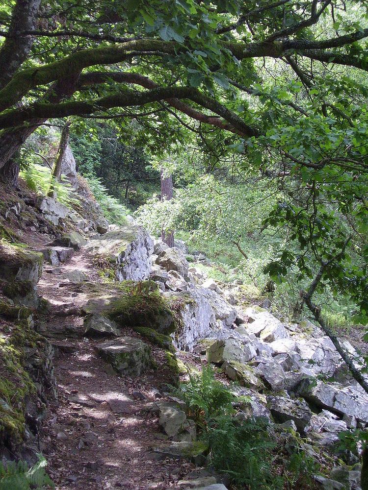
Normandie-Maine Regional Natural Park (Fr.: Parc naturel régional Normandie-Maine) is a protected area of forest and bocage located in the French regions of Lower Normandy and Pays-de-la-Loire.

Contents

Geography

Spanning the departments of Orne, Manche, Mayenne, and Sarthe, the Normandie-Maine park was created in 1975 with a total area of 234,000 hectares (580,000 acres). As of 2011, the parkland has expanded to a total area of 257,000 hectares (640,000 acres) and includes 164 communes with fourteen associated partner communes; the number of inhabitants within the park is approximately 171,000. The park encompasses the Sarthe river valley and the large Forest of Andaines.

Member communes

  • Aillières-Beauvoir • Ambrières-les-Vallées • Antoigny • Assé-le-Boisne • Aunay-les-Bois • Avrilly •
  • Bagnoles-de-l'Orne • Barenton • La Baroche-sous-Lucé • Beaulandais • Beauvain • La Bellière • Bion • Boitron • Le Bouillon • Boulay-les-Ifs • Bourg-le-Roi • Bursard •
  • Carrouges • Ceaucé • Le Cercueil • Chahains • Le Champ-de-la-Pierre • Champfrémont • Champsecret • La Chapelle-d'Andaine • La Chapelle-près-Sées • La Chaux • Ciral • Colombiers • La Coulonche • Coulonges-sur-Sarthe • Couptrain • Couterne • Crissé •
  • Domfront • Dompierre •
  • Essay •
  • La Ferrière-Béchet • La Ferrière-Bochard • La Ferrière-aux-Étangs • La Ferté-Macé • Fontenai-les-Louvets • Forges • Francheville • La Fresnaye-sur-Chédouet •
  • Gandelain • Geneslay • Ger • Gesvres •
  • Haleine • La Haute-Chapelle • Hauterive • Héloup • Le Housseau-Brétignolles •
  • Joué-du-Bois • Juvigny-sous-Andaine •
  • Lalacelle • Laleu • La Lande-de-Goult • Lassay-les-Châteaux • Le Grez • Lignières-Orgères • Livaie • Livet-en-Saosnois • Longuenoë • Lonlay-l'Abbaye • Loré • Louzes • Lucé •
  • Magny-le-Désert • Marchemaisons • Méhoudin • Le Mêle-sur-Sarthe • Le Ménil-Broût • Ménil-Erreux • Le Ménil-Scelleur • Mieuxcé • Mont-Saint-Jean • La Motte-Fouquet • Moulins-le-Carbonnel •
  • Neufchâtel-en-Saosnois • Neuilly-le-Bisson • Neuilly-le-Vendin •
  • Pacé • La Pallu • Perrou • Pezé-le-Robert • Pré-en-Pail •
  • Radon • Ravigny • Rennes-en-Grenouilles • La Roche-Mabile • Rouellé • Rouessé-Vassé • Rouperroux •
  • Saint-Aubin-d'Appenai • Saint-Brice • Saint-Calais-du-Désert • Saint-Céneri-le-Gérei • Saint-Christophe-le-Jajolet • Saint-Cyr-en-Pail • Saint-Denis-de-Villenette • Saint-Denis-sur-Sarthon • Saint-Didier-sous-Écouves • Saint-Ellier-les-Bois • Saint-Fraimbault • Saint-Georges-de-Rouelley • Saint-Georges-le-Gaultier • Saint-Gervais-du-Perron • Saint-Gilles-des-Marais • Saint-Hilaire-la-Gérard • Saint-Jean-du-Corail • Saint-Julien-sur-Sarthe • Saint-Léger-sur-Sarthe • Saint-Léonard-des-Bois • Saint-Martin-des-Landes • Saint-Martin-l'Aiguillon • Saint-Maurice-du-Désert • Saint-Michel-des-Andaines • Saint-Nicolas-des-Bois • Saint-Ouen-le-Brisoult • Saint-Patrice-du-Désert • Saint-Paul-le-Gaultier • Saint-Pierre-des-Nids • Saint-Pierre-sur-Orthe • Saint-Rémy-de-Sillé • Saint-Rémy-du-Val • Saint-Rigomer-des-Bois • Saint-Samson • Saint-Sauveur-de-Carrouges • Sainte-Marguerite-de-Carrouges • Sainte-Marie-du-Bois • Sainte-Marie-la-Robert • La Sauvagère • Sées • Sept-Forges • Sillé-le-Guillaume • Sougé-le-Ganelon •
  • Tanville • Tessé-Froulay • Thubœuf • Torchamp •
  • Les Ventes-de-Bourse • Villaines-la-Carelle • Villepail • Vimarcé • Vingt-Hanaps • Vrigny •
  • References

    Normandie-Maine Regional Natural Park Wikipedia