
Time zone CET (UTC+1) Population 85,055 (31 Dec 2014) Team FSV Wacker 90 Nordhausen | Vehicle registration NDH Capital Nordhausen | |
 | ||
Website www.landratsamt-nordhausen.de University Nordhausen University of Applied Sciences Points of interest Kohnstein, KZ Mittelbau‑Dora Memorial, Hohnstein Castle, Flohburg, Tabakspeicher Destinations | ||
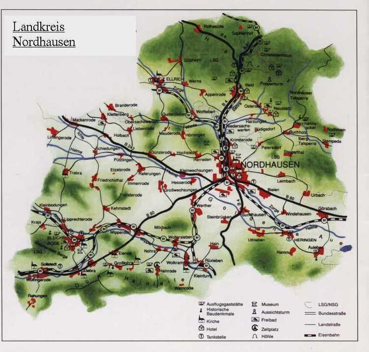
Nordhausen is a Kreis (district) in the north of Thuringia, Germany. Neighboring districts are (from the north clockwise) Harz and Mansfeld-Südharz in Saxony-Anhalt, the district Kyffhäuserkreis, Eichsfeld in Thuringia and the districts Göttingen and Goslar in Lower Saxony.
Contents
Map of Nordhausen, Germany
History
The district was created in 1815, when the Prussian province Saxony was created. The area Lohra-Clettenberg (the former dukedom County Hohnstein) and the previously free imperial city Nordhausen were thereafter administrated together. 1882/83 the city Nordhausen left the district, which led to the renaming of the district to Kreis Grafschaft Hohenstein (district county Hohenstein) in 1888. After World War II the district was named back to Landkreis Nordhausen, and in 1950 the city Nordhausen had to join the district again. In the administrative reform of 1952 several municipalities changed the district - several changed from the district Sangerhausen into the district Nordhausen, while others from Nordhausen changed into the districts Worbis, Wernigerode, Sondershausen and Sangerhausen.
Geography
The district is located in the southern foothills of the Harz mountains. Highest elevation is the Große Ehrenberg, with a height of 635.3 m above sea level. The main river in the district is the Zorge. To the south are the hill chains of the Dün, Hainleite and Windleite.