
Country Thailand Time zone THA (UTC+7) Area 445.5 km² Province Lopburi Province | Seat Nong Muang Postal code 15170 Population 35,257 (2005) Geocode 1611 | |
 | ||
Nong Muang (Thai: หนองม่วง, [nɔ̌ːŋ mûa̯ŋ]) is a district (amphoe) in the northern part of Lopburi Province, central Thailand.
Contents
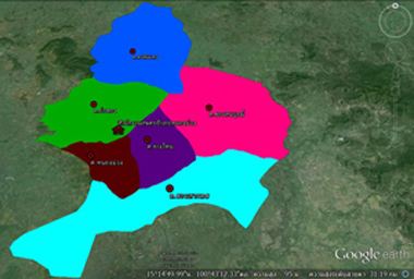
Map of Nong Muang District, Lopburi, Thailand
History
Following a suggestion issued in 1989, six tambon were separated from Khok Samrong to form the new minor district (King Amphoe) Nong Muang on April 1, 1990. The minor district was upgraded to full district status on December 5, 1996.
Geography
Neighboring districts are (from the northeast clockwise) Khok Charoen, Sa Bot, Khok Samrong, Ban Mi, and the districts Takhli, Tak Fa and Phaisali of Nakhon Sawan Province.
Administration
The district is subdivided into 6 subdistricts (tambon), which are further subdivided into 67 villages (muban). Nong Muang itself has township (thesaban tambon) status and covers part of the tambon Nong Muang. There are 6 Tambon administrative organizations (TAO).