Country Thailand Time zone THA (UTC+7) Area 341.2 km² Province Uthai Thani Province | Seat Nong Chang Postal code 61110 Population 44,366 (2008) Geocode 6104 | |
 | ||
Nong Chang (Thai: หนองฉาง) is a district (Amphoe) of Uthai Thani Province, northern Thailand.
Contents
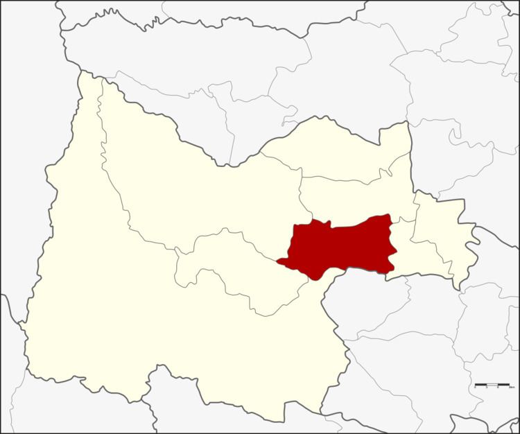
Map of Nong Chang District, Uthai Thani, Thailand
Geography
Neighboring districts are (from the southwest clockwise) Huai Khot, Lan Sak, Thap Than, Nong Khayang of Uthai Thani Province and Nong Mamong of Chainat Province.
History
In 1917 the district was renamed from Uthai Kao (อุทัยเก่า) to Nong Chang.
Administration
The district is subdivided into 10 subdistricts (tambon), which are further subdivided into 96 villages (muban). There are two subdistrict municipalities (thesaban tambon) in the district - Khao Bang Kraek covers the whole tambon Khao Bang Kraek, and Nong Chang covers parts of tambon Nong Chang and Nong Suang.
References
Nong Chang District Wikipedia(Text) CC BY-SA
