
 | ||
Similar Nomans Land Island Na, Elizabeth Islands, Moshup Trail, Chappaquiddick Island, Muskeget Island | ||
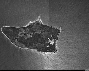
Nomans Land (also mapped "No Man's Land," "No Mans Land," or "No Man's island") is an uninhabited island 612 acres (2.48 km2) in size, located in the town of Chilmark, Dukes County, Massachusetts. It is situated about 3 miles (4.8 km) off the southwest corner of the island of Martha's Vineyard.
Contents
Map of Nomans Land, Chilmark, MA 02535, USA
The island was used by the United States Navy as a practice bombing range from 1943 to 1996. In 1998, the Navy transferred the island to the United States Fish and Wildlife Service for use as an unstaffed wildlife refuge. Due to safety risks from unexploded ordnance and its value as a wildlife habitat, the island is closed to all public use.
History
In 1602, during the British ship Concord's exploration of Cape Cod, Captain Bartholomew Gosnold named Nomans Land "Martha's Vineyard" after his eldest daughter, Martha. However, the name was later transferred to the larger island currently known as Martha's Vineyard, which is located northeast of Nomans Land.
The island was probably named "Nomans Land" after a Martha's Vineyard Wampanoag sachem, Tequenoman, who had jurisdiction over the island when the English came in the early 17th century: named from "TequeNoman's Land" (figurative phrase).
An entail of 1695 mentions that William Nicoll of Islip Grange, Long Island, New York owned the Island of Normans Land near "Martins Vineyard" recalling the fact that on December 19, 1685 Gov. Dongan, Lord of the Manor of Martha's Vineyard (including Normans Land) had made Nicoll his Steward there.
An airfield was constructed by the U.S. Navy on the southern edge of the island between November 1942 and May 1944, and the island was used, beginning in World War II, as Nomans Land Range for 53 years, 1943-1996. The airfield was abandoned by the U.S. Navy sometime between 1945 and 1954, though usage as a bombing range continued until 1996.
In 1952 the island was sold by the Crane family to the Navy.
The eastern third of the island has been managed by the Fish and Wildlife Service since 1975. Following an effort to clear the island of ordnance in 1997 and 1998, the rest of the island was transferred to the Fish and Wildlife Service for use as a wildlife refuge, primarily for migratory birds.