
 | ||
Similar Noguera Pallaresa, Canelles Reservoir, El Montsec d'Ares, Ermita de la Mare de Déu de la, Embalse de Escales | ||
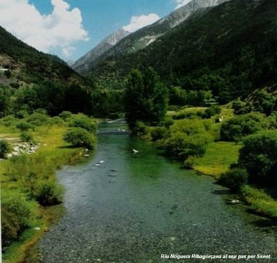
The Noguera Ribagorçana ([nuˈɣeɾə riβəɣurˈsanə] [noˈɣeɾa riβaɣoɾˈsana]) or Noguera Ribagorzana ([noˈɣeɾa riβaɣorˈθana]) is a river in northern Spain.
Map of Riu Noguera Ribagor%C3%A7ana, Spain
For much of its course of 130 km it forms the administrative boundary between Catalonia and Aragon. Its source is in the municipality of Vielha e Mijaran (Aran Valley) at an elevation of about 2400 m, and its upper valley forms the main access route to the Aran Valley (N-230 road and the Vielha tunnel (5230 m long) under the watershed). It passes through the traditional county of Ribagorça and the town of Pont de Suert (Alta Ribagorça). Dams form two large reservoirs, the Escales below Pont de Suert and the Canelles above Ivars de Noguera (Noguera). The Noguera Ribagorçana joins the Segre from the right at Vilanova de la Barca (Segrià). It drains a basin of 2036 km².