
Country Thailand Amphoe established 1997 Postal code 17130 Population 17,371 (2008) Geocode 1808 | Seat Noen Kham Time zone THA (UTC+7) Area 270 km² Province Chai Nat Province | |
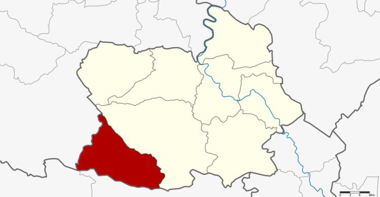 | ||
Noen Kham (Thai: เนินขาม) is the southwesternmost district (Amphoe) of Chainat Province, central Thailand.
Contents
Map of Noen Kham District, Chai Nat, Thailand
History
The two tambon Noen Kham and Kabok Tia of Hankha district were separated and created the new minor district (King Amphoe) on July 1, 1997.
Following a decision of the Thai government on May 15, 2007, all of the 81 minor districts were to be upgraded to full districts. With the publishing in the Royal Gazette on August 24 the upgrade became official
Geography
Neighboring districts are (from the north clockwise) Hankha of Chainat Province, Doem Bang Nang Buat, Dan Chang of Suphanburi Province and Ban Rai of Uthai Thani Province.
Administration
The district is subdivided into 3 subdistricts (tambon), which are further subdivided into 48 villages (muban). There are no municipal (thesaban) areas, and 3 Tambon administrative organizations (TAO).