
District Uthungulu Elevation 1,090 m (3,580 ft) Local time Tuesday 12:15 PM | Postal code (street) 3855 up to 3859 Area code 035 | |
 | ||
Weather 23°C, Wind E at 8 km/h, 68% Humidity | ||
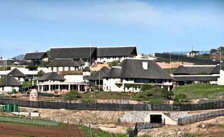
Nkandla is a town in the uThungulu district of KwaZulu-Natal, South Africa. It is the seat of the Nkandla Local Municipality, and the district in which the residence of the current President of South Africa, Jacob Zuma is located. The residence is located 40 kilometres to the south of the town of Nkandla, beyond the Nkandla Forest and on the road to Kranskop.
Map of Nkandla, 3855, South Africa
The Nkandla region encompasses nearly 115,000 inhabitants, spread relatively sparsely over a large area. Nkandla is mainly a rural area and is in the top five of the poorest places in KwaZulu-Natal province. Poverty is prevalent, with 44% unemployment. The majority of the population are Zulus.
A 2004 documentary, The Orphans of Nkandla, by the BBC and Truevision, recounted the hardships and poverty of orphans in Nkandla.
Zuma was joined by Nelson Mandela to open Mnyakanya High School in 2004.