Coat of arms Flag Urban-type settlements 1 Area 1,672 km² | Country Russia Rural localities 61 | |
 | ||
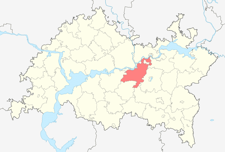
Nizhnekamsky District (Russian: Нижнека́мский райо́н; Tatar: Түбән Кама районы, Tübən Kama rayonı) is an administrative and municipal district (raion), one of the forty-three in the Republic of Tatarstan, Russia. It is located in the center of the republic. The area of the district is 1,672.3 square kilometers (645.7 sq mi). Its administrative center is the city of Nizhnekamsk (which is not administratively a part of the district). Population: 37,860 (2010 Census); 37,811 (2002 Census); 34,696 (1989 Census).
Contents
- Map of Nizhnekamsky District Republic of Tatarstan Russia
- Administrative and municipal status
- References
Map of Nizhnekamsky District, Republic of Tatarstan, Russia
Administrative and municipal status
Within the framework of administrative divisions, Nizhnekamsky District is one of the forty-three in the republic. The city of Nizhnekamsk serves as its administrative center, despite being incorporated separately as a city of republic significance—an administrative unit with the status equal to that of the districts (and which, in addition to Nizhnekamsk, also includes three rural localities).
As a municipal division, the district is incorporated as Nizhnekamsky Municipal District, with the city of republic significance of Nizhnekamsk being incorporated within it as Nizhnekamsk Urban Settlement.
