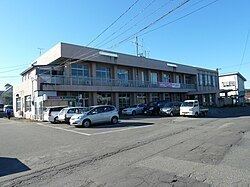
Population 6,695 (Sep 2014) | Area 298.1 km² Local time Tuesday 1:38 PM | |
 | ||
Weather 5°C, Wind W at 18 km/h, 71% Humidity Points of interest Ōyamazumi Shrine, Torioikannonnyohoji, Mt. Koyo, Iitanisan, Toriyasan, Kagamiyama | ||
Nishiaizu (西会津町, Nishiaizu-machi) is a town located in Yama District, Fukushima Prefecture, in northern Honshū, Japan. As of September 2014, the town had an estimated population of 6,695 and a population density of 22.5 persons per km². Approximately 66% of the population is over the age of 65. The total area was 298.13 km². About 86 percent of the total area is composed of mountains and forests.
Contents
- Map of Nishiaizu Yama District Fukushima Prefecture Japan
- Geography
- Neighboring municipalities
- History
- Education
- Railway
- Highway
- Local attractions
- References
Map of Nishiaizu, Yama District, Fukushima Prefecture, Japan
Geography
Nishiaizu is located at the far northwestern corner of the Aizu region of Fukushima Prefecture, bordered Niigata Prefecture to the north and the west. The climate is like many other parts of northern Japan, with cold winters and snowfall averaging 2 meters. It is known as the "front door" to the Iide Mountains.
Neighboring municipalities
History
The area of present-day Nishiaizu was part of ancient Mutsu Province and formed part of the holdings of Aizu Domain during the Edo period. After the Meiji Restoration, it was organized as part of Yama District.
Modern Nishiaizu was founded on July 1, 1954 through a merger of the villages of Shingo and Okugawa with the town of Nozawa and villages of Onomoto, Tosejima, Mutsuai, Shitatani, Muraoka, Kaminojiri and Hosaka in Kawanuma District. In 2006, Nishiaizu residents decided to decline a merger with the city of Kitakata.
