
Population 6.39 million (2011) Languages spoken Lanyin Mandarin, Zhongyuan Mandarin Area 66,000 km2 | Capital Yinchuan Governor Liu Hui | |
Colleges and Universities Ningxia University, Northern Nationalities University, Ningxia Medical College | ||
Ningxia (Chinese: ; pinyin: ; Wade–Giles: ; pronounced [ni??ja, officially the Ningxia Hui Autonomous Region (NHAR), is an autonomous region of the Peoples Republic of China located in the northwest part of the country. Formerly a province, Ningxia was incorporated into Gansu in 1954 but was separated from Gansu in 1958 and was reconstituted as an autonomous region for the Hui people, one of the 56 officially recognised nationalities of China.
Contents
- Map of Ningxia
- Taiwan travel vlog ningxia night market etude house
- Ningxia night market travel guide
- History
- Geography
- Economy
- Tourism
- Museums
- Young living ningxia red what is it why should you drink it
- References
Map of Ningxia
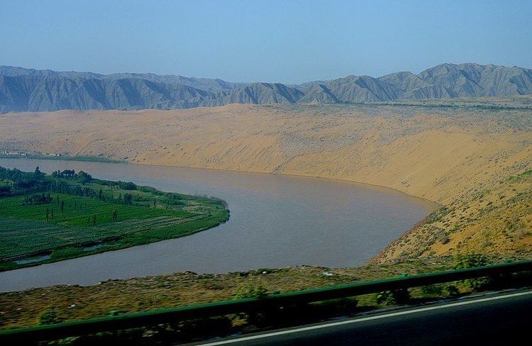
Ningxia is bounded by Shaanxi to the east, Gansu to the south and west, and Inner Mongolia Autonomous Region to the north and has an area of around 66,400 square kilometres (25,600 sq mi). This sparsely settled, mostly desert region lies partially on the Loess Plateau and in the vast plain of the Yellow River, and features the Great Wall of China along its northeastern boundary. Over the years an extensive system of canals has been built. Extensive land reclamation and irrigation projects have made increased cultivation possible.
Taiwan travel vlog ningxia night market & etude house
Ningxia night market travel guide
History

Ningxia and its surrounding areas were incorporated into the Qin Dynasty as early as the 3rd century BC. Throughout the Han Dynasty and the Tang Dynasty there were several large cities established in the region. The Liang Province Rebellion at the end of the Han Dynasty affected Ningxia.
By the 11th century the Tangut people had established the Western Xia Dynasty on the outskirts of the then-Song Dynasty. Jews also lived in Ningxia, as evidenced by the fact that, after a major flood destroyed Torah scrolls in Kaifeng, a replacement was sent to the Kaifeng Jews by the Ningbo and Ningxia Jewish communities.
It then came under Mongol domination after Genghis Khan conquered Yinchuan in the early 13th century. Muslims from Central Asia also began moving into Ningxia from the west. The Muslim Dungan Revolt of the 19th century affected Ningxia.
In 1914, Ningxia was merged with the province of Gansu. However, in 1928 it was detached from Gansu and became a separate province. Between 1914 and 1928, the Xibei San Ma (literally "three Mas of the northwest") ruled the provinces of Qinghai, Ningxia and Gansu. Muslim Kuomintang General Ma Hongkui was the military governor of Ningxia and had absolute authority in the province. The Muslim conflict in Gansu, which lasted from 1927 to 1930, spilled over into Ningxia. From 1950 to 1958, a Kuomintang Islamic insurgency resulted in fighting throughout Northwest China, including Ningxia. In 1954, the Chinese government merged Ningxia with Gansu, but in 1958 Ningxia formally became an autonomous region of China. In 1969, Ningxia received a part of the Inner Mongolian Autonomous Region, but this area was returned in 1979.
A number of Chinese artifacts dating from the Tang dynasty and Song dynasty, some of which had been owned by Emperor Zhenzong, were excavated and then came into the hands of Ma Hongkui, who refused to publicize the findings. Among the artifacts were a white marble tablet from the Tang dynasty, gold nails, and bands made out of metal. It was not until after Ma passed away, that his wife went to Taiwan in 1971 from America to bring the artifacts to Chiang Kai-shek, who turned them over to the Taipei National Palace Museum.
Geography
Ningxia borders the provinces of Shaanxi and Gansu, and the Inner Mongolia Autonomous Region.
The Yellow River flows through Ningxia. The Ningxia ecosystem is one of the least studied regions in the world. Some plant genera in Ningxia have been estimated at over 40,000 years old.
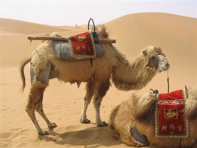
Ningxia is a relatively dry, desert-like region. Significant irrigation supports the growing of wolfberries, a commonly consumed fruit throughout the region.
Ningxias deserts include the Tengger desert in Shapotou.
The northern section, through which the Yellow River flows, supports the best agricultural land. A railroad, linking Lanzhou with Baotou, crosses the region. A highway has been built across the Yellow River at Yinchuan.
On 16 December 1920, the Haiyuan earthquake, 8.6 magnitude, at 36.6°N 105.32°E? / 36.6; 105.32, initiated a series of landslides that killed an estimated 200,000 people. Over 600 large loess landslides created more than 40 new lakes.
In 2006, satellite images indicated that a 700 by 200-meter fenced area within Ningxia—5 km (3.1 mi) southwest of Yinchuan, near the remote village of Huangyangtan—is a near-exact 1:500 scale terrain model reproduction of a 450 by 350-kilometer area of Aksai Chin bordering India, complete with mountains, valleys, lakes and hills. Its purpose is as yet unknown.
Economy
Ningxia is the province with the third smallest GDP (Tibet being the last) in China, even though its neighbors, Inner Mongolia and Shaanxi, are among the strongest emerging provincial economies in the country. Its nominal GDP in 2011 was just 200.0 billion yuan (US$32.7 billion) and a per capita GDP of 21,470 yuan (US$3,143). It contributes 0.44% of the national economy.
Tourism
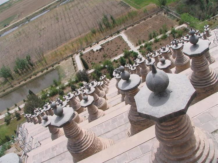
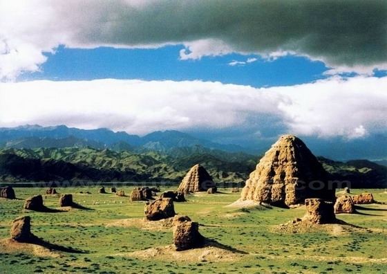
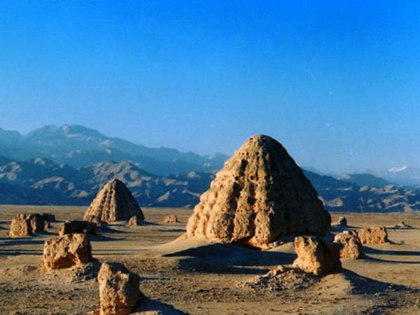
One of Ningxias main tourist spots is the internationally renowned Xixia Tombs site located 30 km (19 mi) west of Yinchuan. The remnants of nine Western Xia emperors tombs and two hundred other tombs lie within a 50 km2 (19 sq mi) area. Other famous sites in Ningxia include Helan Shan, the mysterious 108 dagobas, the twin pagodas of Baisikou and the desert research outpost at Shapatou. A less visited tourist spots in Ningxia is the Mount Sumeru Grottoes (), which is among the ten most famous grottoes in China.