
Species none Abbreviation Ns | Variety none Classification Family C (low-level) Maximum altitude (feet) 10,000 | |
 | ||
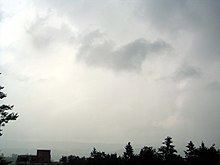
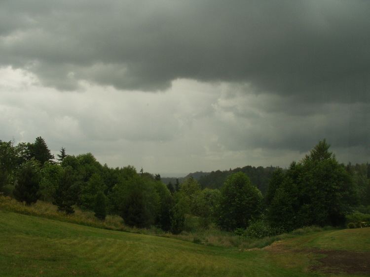
Appearance Dark, widespread, formless layer Indicates precipitation Yes, but may be virga (evaporates before reaching the ground) | ||
Nimbostratus clouds
Nimbostratus is a former "Family C" low-level stratiform genus that is now classified by the World Meteorological Organization (WMO) as a vertical or multi-level stratus type because it forms in the middle level or étage of the troposphere and usually spreads vertically into the low and high étages. This change in classification would once have made it a "Family D" cloud, but this style of nomenclature was discontinued by the WMO in 1956. Nimbostratus usually produces precipitation over a wide area. Nimbo- is from the Latin word nimbus, which denotes precipitation. It has a diffuse cloud base generally found anywhere from near surface in the low levels and about 3,000 m (9,800 ft) in the middle étage. Although usually dark at its base, it often appears illuminated from within to a surface observer. Nimbostratus usually has a thickness of about 2000 m. Though found worldwide, nimbostratus occurs more commonly in the middle latitudes. It is coded CM2 on the SYNOP report.
Contents

Downward-growing nimbostratus can have the same vertical extent as most large upward-growing cumulus, but its horizontal extent tends to be even greater. This sometimes leads to the continued exclusion of nimbostratus from the group of vertical clouds by some independent meteorologists. Classifications that follow this approach usually show nimbostratus either as low-étage to denote its normal base height range, or as middle-etage based on the altitude range at which it normally forms.
Formation
Nimbostratus occurs along a warm front or occluded front where the slowly rising warm air mass creates nimbostratus along with shallower stratus clouds producing less rain, these clouds being preceded by higher-level clouds such as cirrostratus and altostratus. Often, when an altostratus cloud thickens and descends into lower altitudes, it will become nimbostratus.

Nimbostratus, unlike cumulonimbus, is not associated with thunderstorms, however at an unusually unstable warm front caused as a result of the advancing warm air being hot, humid and unstable, cumulonimbus clouds may be embedded within the usual nimbostratus. Lightning from an embedded cumulonimbus cloud may interact with the nimbostratus but only in the immediate area around it. In this situation with lightning and rain occurring it would be hard to tell which type of cloud was producing the rain from the ground, however cumulonimbus tend to produce larger droplets and more intense downpours. The occurrence of cumulonimbus and nimbostratus together is uncommon, and usually only nimbostratus is found at a warm front.
Nimbostratus pannus is an accessory cloud of nimbostratus that forms as a ragged layer in precipitation below the main cloud deck.
Forecast
Usually, nimbostratus is a sign of easily steady to powerful precipitation, as opposed to the shorter period of typically heavier precipitation released by a cumulonimbus cloud. However, precipitation does not occur at ground level in case of virga and accompanies other cloud types. Precipitation may last for several days, depending on the speed of the warm or occluded front it accompanies. A nimbostratus virga cloud is the same as a normal nimbostratus cloud, but the precipitation is virga and it never reaches the ground. Stratus or stratocumulus (comprising the warm sector of a frontal system) usually forms when it clears.
Origin of name
Under Luke Howard's first systematized study of clouds, carried out in France in 1802, three general cloud forms were established based on appearance and characteristics of formation: cirriform, cumiliform and stratiform. These were further divided into upper and lower types depending on altitude. In addition to these three main types, Howard added two names to designate multiple cloud types joined together: cumulostratus, a blending of cumulus clouds and stratus layers, and nimbus, a complex blending of cirriform, cumuliform, and stratiform clouds with sufficient vertical development to produce significant precipitation.
Later, in the 20th Century, an IMC commission for the study of clouds put forward a refined and more restricted definition of the genus nimbus, effectively reclassifying it as a stratiform cloud type. It was then renamed nimbostratus, and published with the new name in the 1932 edition of the International Atlas of Clouds and of States of the Sky. This left cumulonimbus as the only nimbiform type as indicated by its root-name.