
Legislature House of Commons District created 1952 Last contested 2015 Province Ontario | MP Marc Serré
Liberal First contested 1953 District webpage profile, map Elector 72,134 | |
 | ||
All candidates debate nickel belt riding
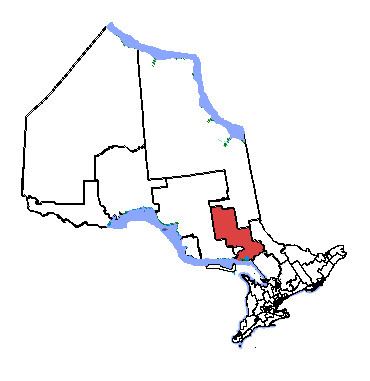
Nickel Belt is one of two federal electoral districts serving the city of Greater Sudbury, Ontario, Canada. It has been represented in the House of Commons of Canada since 1953.
Contents
- All candidates debate nickel belt riding
- Ontario election results 2011 sudbury nickel belt sudbury news
- Geography
- History
- Members of Parliament
- Election results
- References
Ontario election results 2011 sudbury nickel belt sudbury news
Geography
It consists of:
History
The riding of Nickel Belt was created in 1952 from parts of Algoma East, Algoma—Manitoulin, Nipissing, Parry Sound—Muskoka, Sudbury and Timiskaming—Cochrane ridings. It has traditionally included much of the Sudbury District and small parts of the Algoma, Nipissing and Timiskaming Districts, along with all but the urban core of Greater Sudbury.
It consisted initially of parts of the territorial districts of Sudbury and Algoma, and excluding the city of Sudbury, town of Copper Cliff, and the township of McKim. In 1966, it was redefined to consist of parts of the territorial districts of Sudbury excluding the City of Sudbury and the Town of Copper Cliff, and the northeast part of the territorial district of Manitoulin.
In 1976, it was redefined to consist of the southern part of Regional Municipality of Sudbury, the southeast part of the Territorial District of Sudbury, and the part of the Territorial District of Manitoulin including and lying east of the Townships of Killarney, and Rutherford and George Island.
In 1987, it was redefined to consist of the southern part of the Regional Municipality of Sudbury; the geographic townships of Cartier, Cascaden, Foy, Hart, Harty, Hess and Moncrieff and that part of the geographic Township of Trill not within the Town of Walden in the Territorial District of Sudbury; Wahnapitei Indian Reserve No. 11; and Whitefish Lake Indian Reserve No. 6.
In 1996, it was redefined to consist of:
In 2003, it was given its current boundaries as described above.
This riding lost fractions of territory to Nipissing—Timiskaming and Algoma—Manitoulin—Kapuskasing during the 2012 electoral redistribution.
Members of Parliament
This riding has elected the following Members of Parliament:
Election results
Note: Conservative vote is compared to the total of the Canadian Alliance vote and Progressive Conservative vote in 2000 election.
Note: Canadian Alliance vote is compared to the Reform vote in 1997 election.
Note: NDP vote is compared to CCF vote in 1958 election.