
Country New Zealand Territorial authority Area 610.5 km² | Region Hawke's Bay Website www.ngamatea.co.nz Mayor Andy Watson | |
 | ||
Ngamatea station shearing 2014
Ngamatea is a meshblock located in the northeastern part of Rangitikei District of the Hawke's Bay region of New Zealand's North Island. It is unique in being located in the Hawke's Bay region despite being part of the Rangitikei District, which is almost entirely located in the Manawatu-Wanganui region. It has an area of 610.54 km², 13.63% of the total area of Rangitikei. According to the 2013 census, it had a population of 27 inhabitants.
Contents
- Ngamatea station shearing 2014
- Map of Ngamatea New Zealand
- Ngamatea a true hunting experience
- Geography
- Local government
- National government
- Demographics
- Roads
- References
Map of Ngamatea, New Zealand
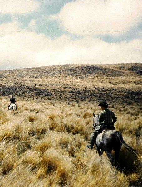
Ngamatea is also a station and provides free-range sika deer hunting and trout fishing.
Ngamatea a true hunting experience
Geography
The meshblock of Ngamatea encompasses an area of 610.54 km². Despite only having 0.2% of the district's population, Ngamatea contains 13.6% of the total area. It is the only part of the Rangitikei District located in the Hawke's Bay region, of which it contains 4.3% of the total area.
Ngamatea has the following boundaries: Taharua (Taupo District, Hawke's Bay) to the north, Puketitiri (Hastings District, Hawke's Bay) to the northeast and east, Whanawhana (Hastings) to the south and Moawhango to the west.
Local government
As part of the Rangitikei District, the current Mayor of Rangitikei since 2013 is Andy Watson.
Ngamatea forms part of the Taihape ward of the Rangitikei District Council, which elects three of the eleven district councillors. The three councillors of the Taihape ward are Richard Aslett, Angus Gordon and Ruth Rainey. The mayor and councillors are all due for re-election in October 2016.
National government
Ngamatea, like the rest of the Rangitikei District, is located in the general electorate of Rangitīkei and in the Māori electorate of Te Tai Hauāuru. Rangitīkei is a safe National Party seat since the 1938 election with the exception of 1978–1984 when it was held by Bruce Beetham of the Social Credit Party. Since 2011 it is held by Ian McKelvie.
Te Tai Hauāuru is a more unstable seat, having been held by three different parties since 1996, i.e. New Zealand First, the Māori Party and the Labour Party. Since 2014 it is held by Adrian Rurawhe of the Labour Party.
Demographics
Ngamatea had a population of 27 according to the 2013 census. This is a decrease of 12, or 30.8 percent, since the 2006 census. There were 12 occupied dwellings, 3 unoccupied dwellings, and no dwellings under construction.
The meshblock had a median age of 23.7 years, 14.3 years below the national median age of 38.0 years. The median annual income of all people 15 years and over was $37,500, compared to $28,500 nationally. No other information is publicly available due to Statistics New Zealand's policy on confidentiality restrictions associated with small communities.
Roads
Ngamatea is served by the Taihape-Napier Road, with no state highways located in the meshblock.