
Country United States County Fairfax ZIP codes 20120-20122 Elevation 117 m Population 71,135 (1 Apr 2010) | State Virginia Time zone EST (UTC-5) FIPS code 51-14440 Area 31.18 km² Area code Area codes 571 and 703 | |
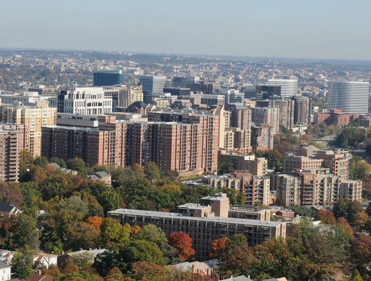 | ||
Centreville is a census-designated place (CDP) in Fairfax County, Virginia, United States and a suburb of Washington, D.C. The boundaries recognized by the U.S. Census Bureau encompassed a population of 71,135 as of the 2010 census Centreville is approximately 20 miles (32 km) west of Washington, DC.
Contents
- Map of Centreville VA USA
- Colonial period
- Federal period
- Civil War
- Modern
- Geography
- Demographics
- Transportation
- Notable people
- Primary and secondary schools
- Public libraries
- Nearby towns communities etc
- References
Map of Centreville, VA, USA
Colonial period
Beginning in the 1760s, the area was known as Newgate due to the popularity of the conveniently-located Newgate tavern. William Carr Lane operated the tavern and was co-proprietor of a nearby store with James Lane, Jr. The Lanes sold convicted servants, which may explain why the tavern had the same name as a London prison. The small stream that passed near the tavern was named the River Thames, another London association. Another reason for it being named Newgate, was the fact that it was a "new gate" to the western territories.
Federal period
The town of Centerville (shortly thereafter spelled Centreville) was established in 1792 on the turnpike road at the village of Newgate by the Virginia General Assembly in response to petitions by local landowners. The petitioners reasoned that a town on the turnpike road leading from the Northwest Territory and centrally located to Alexandria, Colchester, Dumfries, Middleburg, George Town (later Georgetown), Fauquier Court House (later Warrenton), and Leesburg would be convenient. The town acquired its name due to its central location. James Hardage Lane, one of the landowners, conceived the idea of the town as a way to provide financial support to his widow and their children. At the town's inception, it was within the boundary of Loudoun County, Virginia, and became part of Fairfax County, Virginia in 1798 when the boundary between the two counties shifted.
Town development established a pattern of mixed residential and commercial use. Frame houses, several taverns, stores, blacksmith shops, tanyards, and a school house were constructed on the 1/2 acre town lots.
Civil War
In the Civil War, several battles were fought nearby including the First Battle of Manassas, the Second Battle of Manassas, and the Battle of Chantilly. During the winter of 1861 and early 1862 the town was significantly fortified by the Confederacy and served as a supply depot for both sides at various points in the war, and is famous for being the site of the construction of the first railroad ever built exclusively for military use, the Centreville Military Railroad. Centreville was of significant strategic value due to its proximity to several important roads, while its position atop a high ridge provided a commanding view of the surrounding area. The town was frequently associated with Confederate Colonel John S. Mosby, whose partisan rangers used its hillsides and farms as a base of operations, leading to the sobriquet of Mosby's Confederacy.
Modern
In 1943, Centreville was still so small that a state map book individually, on a map of the entire county, indicated each building in the town (and also misspelled its name). In more recent times, Centreville has become a suburb of Washington, D.C. Most of the growth occurred in the late 1990s and early 2000s due the influx of technology companies and the ever-increasing area of the Washington, D.C. suburbs. Centreville is today a typical wealthy American suburb, composed of luxury townhomes, high-end supermarkets, strip malls, a movie theater, and large housing developments. Local newspapers such as The CentreView and the Fairfax Times now record local events and happenings in the community and surrounding communities such as Clifton.
Geography
Centreville is located at 38°50′33″N 77°26′33″W (38.842470, −77.442621).
According to the United States Census Bureau (2010), the CDP has a total area of 12.04 square miles (31.2 km²), 99% of it land.
Demographics
As of the 2010 census, there is a population of 71,135 people and 25,516 households in the CDP. The population density was 5,908/sq mi people per square mile (2,281/km²). The racial makeup of the CDP was 57.0%% White, 25.7% Asian, 7.5% African American, 0.3% Native American, 0.1% Pacific Islander, and 4.4% from two or more races. Hispanic or Latinos of any race were 13.4% of the population.
According to the 2000 census, there were 21,789 households, out of which 41.5% had children under the age of 18 living with them, 54.0% were married couples living together, 10.4% had a female householder with no husband present, and 32.0% were non-families. 21.5% of all households were made up of individuals and 2.1% had someone living alone who was 65 years of age or older. The average household size was 2.74 and the average family size was 3.27.
In the CDP, the population is spread out, with 28.4% under the age of 18, 8.2% from 18 to 24, 43.7% from 25 to 44, 16.4% from 45 to 64, and 3.3% who were 65 years of age or older. The median age was 31 years. For every 100 females, there are 97.6 males. For every 100 females age 18 and over, there were 94.6 males.
According to a 2007 estimate, the median income for a household in the CDP was $87,932, and the median income for a family was $105,803. Males had a median income of $70,123 versus $41,117 for females. The per capita income for the CDP was $40,878. About 2.0% of families and 1.0% of the population were below the poverty line, including 3.0% of those under age 18 and 1.7% of those age 65 or over.
Transportation
Centreville is served by three major roads. U.S. Route 29 enters Centreville from the west and is the main artery through the town. Virginia Route 28 enters from the south and interchanges with U.S. Route 29 in between Centreville's two main shopping centers. SR 620 (Braddock Road) has several stretches of pavement in Centreville. Finally, Interstate 66 comes from the south-west and interchanges with both routes before heading off toward Washington, D.C. in the east or western Virginia. The three roads are part of an interesting, if not frustrating traffic pattern. Drivers heading north on SR 28 are able to exit onto Interstate 66 eastbound, but they must use a one-mile (1.6 km) stretch of US 29 to access the westbound side of the Interstate. Likewise, eastbound Interstate 66's Exit 53 only provides access to SR 28 northbound; one must use Exit 52 and the same stretch of US 29 to reach SR 28 south.
The area is served by several Fairfax Connector bus routes connecting to the Metrorail system: 640, 641, 642.
Notable people
Primary and secondary schools
Residents are zoned to schools in the Fairfax County Public Schools.
Centreville has two middle schools, Liberty Middle School and Ormond Stone Middle School. Some Centreville middle school students also go to Rocky Run Middle School.
Centreville High School, located within the postal boundaries of Clifton, serves much of Centreville. Some of Centreville is served by Chantilly High School and Westfield High School, which opened in 2000 in the community of Chantilly.
The only high school still within Centreville proper is Mountain View Alternative High School. It occupies the building formerly used by Centreville Elementary School.
Although a Loudoun County school, Cardinal Ridge Elementary is located in Centreville.
Public libraries
Fairfax County Public Library operates the Centreville Regional Library in the CDP.