
Northwest end: SH 5 at Waiotapu Length 120.9 km | Southeast end: SH 2 at Wairoa | |
 | ||
State Highway 38 (SH 38) is a road on the North Island of New Zealand that starts from SH 5 near Waiotapu, and ends at Wairoa, where it connects to SH 2. It is the shortest connection from the central North Island (Rotorua) to the East Coast (Gisborne), but it is not often used as such. Large parts of the road are narrow and winding, and about 74 kilometres (46 mi) is unsealed. Travel on this highway takes roughly four hours.
Contents
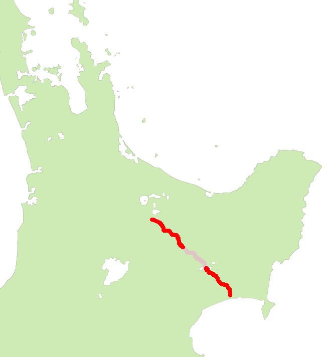
Map of State Highway 38, Hawke's Bay, New Zealand
Part of this unsealed section (between Te Whaiti and Aniwaniwa) is not designated a state highway and instead holds the names Ruatahuna Road and Waikaremoana Road. The administration of this middle section of highway is split between Whakatane District and Wairoa District Councils.
Circa 1990, the length of SH 38 was 198 km from Wairoa to Waiotapu before the middle section designation was revoked. Due to its narrow and twisty nature, trucks are not permitted to tow heavy trailers on the unsealed section of the route.
Route
Starting at the intersection with SH 5, one drives through the Kaingaroa Forest. After 38 km the small town of Murupara is passed. At km 44, at Te Whaiti, a road branches to Minginui, leading into Whirinaki Te Pua-a-Tāne Conservation Park. SH 38 temporarily loses its state highway status. The highway travels south-east for a further 20 km past the settlement of Rautahuna. The next 74 km are unsealed and winds and climbs through Te Urewera. Apart from small settlements like Ruatahuna, only forested mountains are passed. Following small streams the road reaches the borders of Lake Waikaremoana. At km 134, at Aniwaniwa, is a visitor centre of Department of Conservation. This is the place where different walks start, including a short stroll to the Aniwaniwa Falls. At the southern end of the lake, at Onepoto, is a motorcamp. Further south, along the Waikaretaheke River, the three powerstations of the Waikaremoana Power Scheme can be seen.
From Aniwaniwa, SH 38 regains its state highway status and bends into the valley of the Waiau River eventually returning to sealed road. At km 185, at the village of Frasertown, where the Waiau River joins the Wairoa River, the Tiniroto Road branches of to Gisborne (another 97 km). At km 195, at Wairoa, the road finally terminates with SH 2 at the intersection of Mahia Avenue and Bridge Street.