
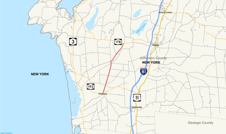
Existed: 1930 – present North end: NY 178 in Adams Length 9.58 km | South end: NY 193 in Ellisburg Counties: Jefferson Constructed 1930 | |
 | ||
County | ||
New York State Route 289 (NY 289) is a north–south state highway in Jefferson County, New York, in the United States. The southern terminus of the route is at NY 193 in the village of Ellisburg near the center of the town of Ellisburg. Its northern terminus is at NY 178 in the extreme southwestern corner of the town of Adams.
Contents
Map of NY-289, New York, USA
Route description
NY 289 begins in the village of Ellisburg at a junction with NY 193. It travels north through the small village on Main Street, then enters the surrounding town of Ellisburg. The route heads onward through open fields to the hamlet of Belleville. Here, NY 289 intersects with County Route 75 (CR 75). CR 75 enters the hamlet from the west and exits to the north while NY 289 continues to the northeast, following Sandy Creek. Before exiting Belleville, NY 289 passes the back road to Belleville–Henderson Central School. The route continues northeast into the town of Adams, where it ends at a junction with NY 178 about 3 miles (5 km) west of where NY 178 connects to Interstate 81 at exit 41.
History
The entirety of NY 289 was assigned as part of the 1930 renumbering of state highways in New York.
Major intersections
The entire route is in Jefferson County.