 | ||
Nbc ny patricia sener swims across new york bight
The New York Bight (shown on some maps as the New York-New Jersey Bight) is an indentation along the Atlantic coast of the United States, extending northeasterly from Cape May Inlet in New Jersey to Montauk Point on the eastern tip of Long Island. The coastal climate of the bight is temperate as the result of direct contact from the Gulf Stream along the coast of North America.
Contents
- Nbc ny patricia sener swims across new york bight
- Gannets bass bunker new york bight 2012
- Geography
- Weather
- Geology
- References
Gannets bass bunker new york bight 2012
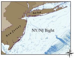
Geography
The bight results from the fact that the Atlantic coast of New Jersey, running approximately north-south, and the southern coast of Long Island, running approximately east-west, form roughly a right angle with the point at the mouth of the Hudson. The New York Bight Apex is the area including and between the Hudson River estuary and the Raritan River estuary extending 6–7 km of the coast and includes Raritan Bay and Lower New York Bay.
Weather
The geography of the bight has long been of major concern to meteorologists in the study of tropical storm patterns along the east coast, and is one of the primary reasons why the New York Metropolitan Area is considered a high danger zone for storm generated ocean-water surges, despite its northerly latitude. Specifically, in the presence of a hurricane off the coast of New Jersey, the easterly cyclonic winds along the northern edge of the storm could drive a strong surge to the west, laterally along the southern coast of Long Island and straight into Lower New York Bay. The angle bend of the New Jersey coast would leave little outlet for the surge, leading to widespread flooding throughout New York City, especially along the southern coast of Staten Island and Manhattan.
Examples of this phenomenon are the hurricane of 1893, in which storm surges of up to 30 feet (9.1 m) were reported, and Hurricane Sandy in 2012.
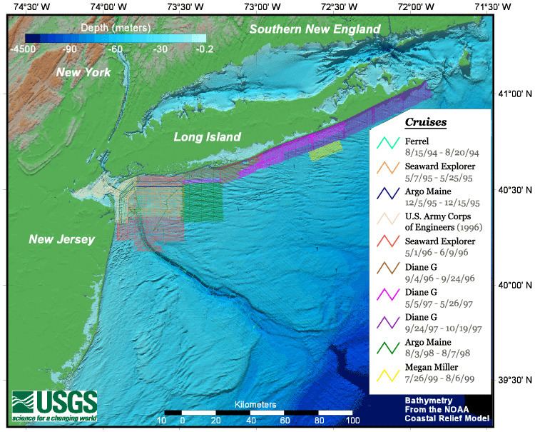
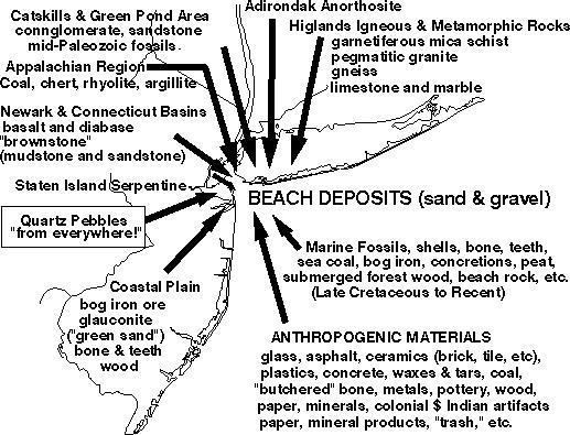
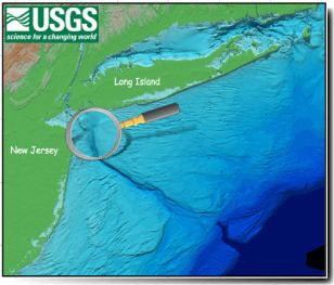
Geology
The sea floor of the New York Bight consists largely of continental shelf and includes the Hudson Canyon, an undersea Pleistocene submarine canyon, which was formed by the Hudson River during the ice ages, when the sea level was lower. The bight includes major shipping channels that access New York Harbor.