
Length 28 mi (45 km) | Season All year | |
 | ||
Trailheads New Gauge, HertfordNew River Head, Islington, London | ||
Ballade of new river path flora bradwell
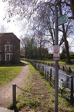
The New River Path is a 28 miles (45 km) long-distance footpath which follows the course of the New River from its source in Hertfordshire to its original end in Islington, London. The path is waymarked throughout its length and all signs display the NR logo.
Contents
- Ballade of new river path flora bradwell
- Map of New River Path Stanstead St Margarets Ware SG12 UK
- History
- Route
- Hertfordshire
- London
- Heritage section
- References
Map of New River Path, Stanstead St Margarets, Ware SG12, UK
History
The New River was completed in 1613, the water supply aqueduct supplies water from Hertfordshire to North London. Since 1992, Thames Water with the co-operation of local people and partners and at the cost of over £2 million have created the path.
Route
The walk can be split into the following three sections.
Hertfordshire
14 miles (23 km)
The path begins at New Gauge, Hertford and passes through a variety of landscapes including the Lee Valley towns and villages of Ware, Great Amwell, St Margarets, Rye House, Hoddesdon, Broxbourne, Turnford, Cheshunt and Waltham Cross
London
11 miles (18 km)
After passing under the M25 the path passes through a range of different scenery from built up urban area corridor to more open aspects and through four London boroughs; Enfield, Haringey, Hackney and Islington.
Heritage section
3 miles (4.8 km)
The path runs through open spaces, inner-city streets and follows the now truncated route of the river till its culmination at New River Head.