
Population 346 (2006 census) Local time Sunday 12:46 AM | Postcode(s) 4876 Postal code 4876 | |
 | ||
Weather 26°C, Wind SW at 5 km/h, 94% Humidity | ||
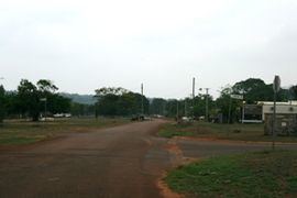
New Mapoon is an area south of Seisia and west of Bamaga at the tip of Cape York Peninsula, adjoining the Lockerbie Scrub. At the 2006 census, New Mapoon had a population of 346.
Map of New Mapoon QLD 4876, Australia
The people who live at New Mapoon were forcibly moved from Marpuna in the early 1960s to accommodate mining expansion on their traditional country. They now have historical association and administrative responsibility for a DOGIT area on the traditional country of the Gudang people. The residents of New Mapoon have a ranger service, which works closely with the Injinoo and other Northern Peninsula Area (NPA) community rangers to undertake land management practices in the NPA.
New Mapoon has a library (Indigenous Knowledge Centre), General store, Arts and Craft and Bait and Tackle shop.