
Population 9,236 (2006 census) Time zone AEST (UTC+10) Postal code 2305 | Postcode(s) 2305 Area 5.5 km² Local time Sunday 1:05 AM | |
 | ||
Weather 21°C, Wind N at 2 km/h, 87% Humidity | ||
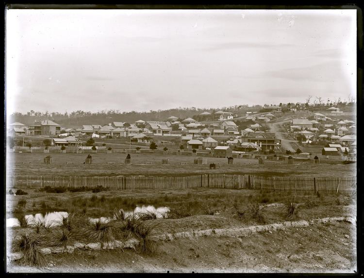
New Lambton is a suburb of Newcastle, in the Hunter Region of New South Wales, Australia. It is located about 6 km (4 mi) west of the Newcastle CBD. It includes two shopping districts, schools and other general facilities. At the 2006 Australian census it had a population of 9,236.
Contents
- Map of New Lambton NSW 2305 Australia
- Geography
- Early years
- 1901
- Later years
- Transport
- Blackbutt Reserve
- Sport
- References
Map of New Lambton NSW 2305, Australia
Initially a coal mining township, New Lambton later became a municipality until it was eventually incorporated into Greater Newcastle. The suburb, which is primarily residential, includes a 182 ha (450-acre) nature reserve and a major regional sports centre.
Geography
The suburb is irregularly shaped, covering an area of approximately 5.5 km2 (2.1 sq mi). While mainly residential in nature, the entire south-western part of the suburb is occupied by Blackbutt Reserve, a 182 ha (450-acre) nature reserve consisting primarily of natural bushland. The east of the suburb is predominantly level and only a few metres above sea level, but rises to approximately 90 m (300 ft) above mean sea level in the western areas, the highest parts of the suburb being in Blackbutt Reserve.
Early years
New Lambton was originally a coal mining township, with the New Lambton Colliery situated to the east across the railway in what is now Adamstown.
On 8 January 1889 New Lambton was incorporated as a Municipality covering 2,560 acres (10 km2).
1901
In 1901 New Lambton had a population of 1,464. The Municipal Council consisted of the following:
The council derived a considerable revenue from the district's largest mine, the Scottish-Australian Coal Mining Company's Lambton Colliery, managed by the three Croudace brothers, Frank, Thomas, & Sydney, which although closer to Lambton fell within the New Lambton municipality. One of the district's principal thoroughfares today is Croudace Street.
The town was free of debt, and had a telegraph office, Council Chambers (erected at a cost of £550), the New Lambton Mechanics Institute, a reading room, fire brigade, public school, good streets and "many signs of advancement". The Member for Kahibah in the New South Wales Legislative Assembly, including New Lambton, was Alfred Edden.
Later years
In 1938 an Act of the New South Wales Parliament created the "City of Greater Newcastle", which incorporated eleven municipalities, including New Lambton, into one local government area.
During World War II, New Lambton Public School was requestioned by the government and used as No. 2 Fighter Sector Headquarters. In recognition of this, the school was granted permission in 1995 to fly the Royal Australian Air Force Ensign and is the only school in Australia allowed to do so.
New Lambton once boasted an art-deco cinema, The Savoy, now the New Lambton Community Centre.
Transport
New Lambton is bordered by, or crossed by various arterial roads. Lookout Road, which joins Croudace Road, borders the suburb to the west. To the east, Lambton Road facilitates access to the Newcastle CBD. To the south, Carnley Avenue and Northcott Drive provide access to the City of Lake Macquarie suburbs. The south-east of the suburb is bordered by the Main Northern Railway, where the suburb is serviced by Adamstown railway station.
Blackbutt Reserve
The entire south-western corner of the suburb is occupied by Blackbutt Reserve. The main entrances of the reserve, in Carnley Avenue and Freyburg Street, are approximately 8.8 km (5.5 mi) by road from the Newcastle CBD. Covering 182 hectares (450 acres), the reserve is mainly urban bushland, and includes nature trails, wildlife exhibits, children’s playgrounds and recreational facilities. The reserve, which is administered by the Newcastle City Council, has over 16 km (10 mi) of tracks meandering through open rainforest.
There are four main picnic and recreational areas in the reserve, off different entry points:
Sport
New Lambton includes several parks where various sports are played. At the north-eastern corner of the suburb, is the Newcastle International Sports Centre, a venue used by the National Rugby League's Newcastle Knights and the A-League's Newcastle Jets. The suburb is also home to the New Lambton Football Club, whose home ground is Novocastrian Park and Western Suburbs Cricket Club, who call Harker Oval home.