
Counties: Cheshire | Length 5.562 km | |
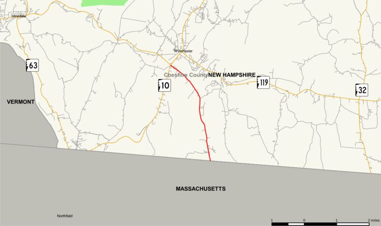 | ||
New Hampshire Route 78 (abbreviated NH 78) is a 3.456-mile-long (5.562 km) secondary state highway in Cheshire County in the southern part of the U.S. state of New Hampshire. A northward extension of Massachusetts Route 78, NH 78 runs entirely within the town of Winchester from the state border to downtown, where it ends at New Hampshire Route 10 and New Hampshire Route 119.
Contents
Map of NH-78, Winchester, NH 03470, USA
Route description
NH 78 begins at the Massachusetts–New Hampshire state border where it meets the northern end of Massachusetts Route 78. The short highway runs for just under 3.5 miles northwest to downtown Winchester, where it ends at its intersection with NH 10 and NH 119. There are no major intersections between its endpoints.
Junction list
The entire route is in Winchester, Cheshire County.
References
New Hampshire Route 78 Wikipedia(Text) CC BY-SA