
Length 59.55 km | ||
 | ||
County | ||
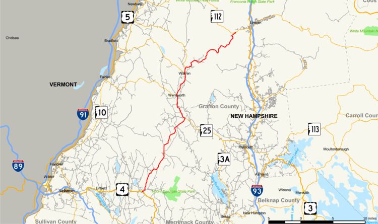
New Hampshire Route 118 (abbreviated NH 118) is a 37.003-mile-long (59.551 km) secondary north–south highway in Grafton County, New Hampshire. NH 118 stretches from Woodstock in the White Mountains Region south to Canaan in the Upper Valley region.
Contents
Map of NH-118, New Hampshire, USA
The northern terminus of NH 118 is at New Hampshire Route 112 (the Lost River Road) in Woodstock. The road runs southward through the towns of Warren, Wentworth, Rumney, and Dorchester. The southern terminus of NH 118 is at U.S. Route 4 in Canaan. From Canaan to Wentworth, the highway is named Dorchester Road. The section from Warren to the Lost River is known as the Sawyer Highway.
Major intersections
The entire route is in Grafton County.
References
New Hampshire Route 118 Wikipedia(Text) CC BY-SA