
Population 11,330 (2011 census) Area 200 ha | Postcode(s) 4005 Postal code 4005 | |
 | ||
Location 2 km (1 mi) from Brisbane CBD LGA(s) City of Brisbane(Central Ward) | ||
New Farm is an affluent, riverside inner suburb of Brisbane, Australia. The suburb is located 2 kilometres east of the Brisbane CBD on a large bend of the Brisbane River. New Farm is partly surrounded by the Brisbane River, with land access from the north-west through Fortitude Valley and from the north through Newstead. Merthyr is a neighbourhood within New Farm; until 1975 it was a separate suburb.
Contents
- Map of New Farm QLD 4005 Australia
- Attractions
- History
- Demographics
- Housing
- Heritage listings
- Transport
- References
Map of New Farm QLD 4005, Australia
At the 2011 Australian Census the suburb recorded a population of 11,330. It has the highest population density in Greater Brisbane with approximately 5,861.7 people per square kilometre.
Attractions
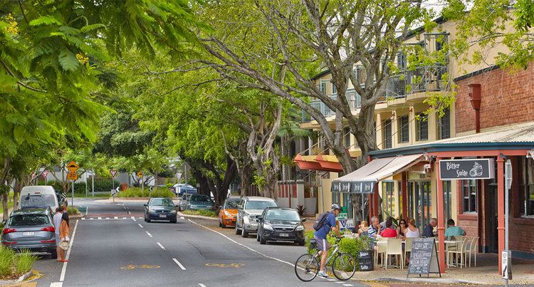
At the south-eastern end of the peninsula is the historic New Farm Park. The suburb derives its name from the fact that the peninsula was used as a farming area in the early years of Brisbane's history. Brunswick Street is the main street running northwest-southeast up the centre of the peninsula. To the south of Brunswick Street the suburb is characterised by large ornate Queenslander-style houses, shady streets lined with large trees and tall apartment buildings, predominantly along the river. More modest Queenslander-style houses dominate the north of Brunswick Street, where there are fewer large trees and apartments.
The suburb has one main commercial area close to New Farm Park, called 'Merthyr Village'. A wide variety of businesses also operate along Brunswick Street and in adjacent streets. The former electric tramway power station, located at the eastern corner of New Farm Park, has been converted into a community arts and performance space called 'The Powerhouse'. New Farm is known as Brisbane's "Little Italy" as many immigrants from Italian descent first settled in the suburb.
History
Though one of Brisbane's oldest suburbs, the peninsula of New Farm was once called Binkinba (place of the land tortoises) by the indigenous Turrbal tribe of Brisbane. Patrick Logan established a farm in the area in 1827. According to a recent book, Reflections on New Farm, published by the New Farm and Districts Historical Society the area was also a working site of convicts (lime kilns dating back to 1870 are still evident on the river banks) a marine base in World War II and home to many wealthy merchants and lawyers. Politician and judge Samuel Griffith built his house 'Merthyr' in the suburb in 1870.
From 1885 to 1897 New Farm's transport needs were met by horse-drawn trams, which operated along Brunswick Street, as far as Barker Street. In 1897, the horse trams were replaced with electric trams and the line was extended, with trams ultimately running as far as Macquarie Street and down to the river at New Farm Park. The electric trams ceased operation on 13 April 1969. Since then the suburb has been served by diesel buses.
New Farm developed a reputation in the late 1980s as a drug-addled, low-rent culture depicted in Andrew McGahan's grunge novel Praise, which is set largely in the suburb.
Since then, and like many Brisbane suburbs, New Farm has experienced much 'gentrification' and 'infill development' throughout the 1990s and the years since 2000. However, New Farm maintains its diversity, being known for its long-established Anglo-Saxon and Italian communities (as depicted in Venero Armanno's novel Firehead), and its many restaurants and cafes.
On 23 January 2007, part of the movie Fool's Gold, starring Kate Hudson, was shot at New Farm Park. Scenes from the films All My Friends Are Leaving Brisbane (2007) and Jucy (2011) have also been shot there.
Demographics
In the 2011 census, New Farm had a population of 11,330 people; 49.9% female and 50.1% male.
The median age of the New Farm population was 36 years of age, 1 year below the Australian median. Children aged under 15 years made up 8.0% of the population and people aged 65 years and over made up 13.5% of the population.
63.5% of people living in New Farm were born in Australia, compared to the national average of 69.8%; the next most common countries of birth were England 4.6%, New Zealand 3.9%, Italy 1.9%, China 1.4%, South Africa 1.1%.
77.2% of people spoke only English at home; the next most popular languages were 3.1% Italian, 1.9% Cantonese, 1% Mandarin, 0.9% Nepali, 0.8% French.
The most common religious affiliation was "No Religion" (30.9%); the next most common responses were Catholic 27.3%, Anglican 12.6%, Uniting Church 3.0% and Buddhism 2.9%.
Housing
The suburb has an eclectic mix of 19th century colonial homes, 20th century traditional Queenslander and modern architectural hybrids. As apartment, unit and duplex housing continues to exceed its share beyond 70% of the local dwelling mix - detached housing is increasing in demand and price.
Heritage listings
New Farm has a number of heritage-listed sites, including:
Transport
By Ferry At the river end of Brunswick Street a small cross-river ferry, operated by Brisbane Transport links New Farm with Norman Park. New Farm can also be accessed via two CityCat stops (operated by Brisbane Transport) - at Sydney Street and at New Farm Park.
By Bus The suburb is serviced by several bus routes to and from the city centre.
The Smart Cities: Rethinking the City Centre report proposes building green bridges from Merthyr Road across the Brisbane River to Bulimba in the east and to Kangaroo Point in the west.