
Time zone Mountain (MST) (UTC-7) Elevation 1,706 m Population 4,574 (2013) Area code 970 | Incorporated (town) March 27, 1890 FIPS code 08-53395 Zip code 81647 Local time Saturday 1:05 AM | |
 | ||
Weather 3°C, Wind SE at 13 km/h, 60% Humidity Area 6.967 km² (6.889 km² Land / 8 ha Water) | ||
Trip to new castle colorado
The Town of New Castle is a Home Rule Municipality in Garfield County, Colorado, United States. The population was 4,518 at the 2010 census, up from 1,984 at the 2000 census.
Contents
- Trip to new castle colorado
- Map of New Castle CO 81647 USA
- The mystery of burning mountain in new castle colorado
- Geography
- Demographics
- References
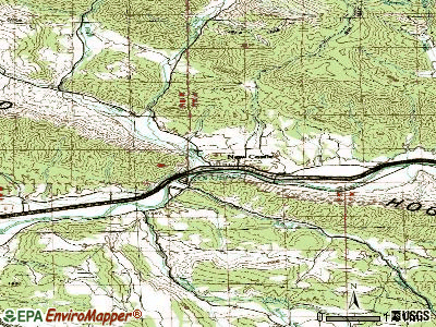
Map of New Castle, CO 81647, USA
The mystery of burning mountain in new castle colorado
Geography
New Castle is located at 39°34′20″N 107°32′6″W (39.572304, -107.534941), on the north side of the Colorado River, just east of where the river cuts through the Grand Hogback. Interstate 70 passes through the town following the river, with access from Exit 105. I-70 leads east 12 miles (19 km) to Glenwood Springs, the county seat, east 169 miles (272 km) to Denver, and west 74 miles (119 km) to Grand Junction. U.S. Route 6 is Main Street in New Castle and forms a parallel route to I-70 for local traffic. US-6 joins I-70 5 miles (8 km) to the east at Chacra and 17 miles (27 km) to the west at a point west of Rifle.
According to the United States Census Bureau, the town has a total area of 2.7 square miles (7.0 km2), of which 2.7 square miles (6.9 km2) is land and 0.04 square miles (0.1 km2), or 1.21%, is water.
Demographics
As of the census of 2000, there were 1,984 people, 705 households, and 537 families residing in the town. The population density was 850.6 people per square mile (328.8/km²). There were 731 housing units at an average density of 313.4 per square mile (121.1/km²). The racial makeup of the town was 94.61% White, 0.30% African American, 0.55% Native American, 0.35% Asian, 3.28% from other races, and 0.91% from two or more races. Hispanic or Latino of any race were 11.90% of the population.
There were 705 households out of which 48.8% had children under the age of 18 living with them, 64.7% were married couples living together, 8.1% had a female householder with no husband present, and 23.7% were non-families. 16.7% of all households were made up of individuals and 2.0% had someone living alone who was 65 years of age or older. The average household size was 2.81 and the average family size was 3.18.
In the town, the population was spread out with 31.9% under the age of 18, 9.5% from 18 to 24, 38.9% from 25 to 44, 16.4% from 45 to 64, and 3.4% who were 65 years of age or older. The median age was 30 years. For every 100 females there were 100.0 males. For every 100 females age 18 and over, there were 99.6 males.
The median income for a household in the town was $55,000, and the median income for a family was $58,889. Males had a median income of $39,597 versus $27,933 for females. The per capita income for the town was $21,356. About 2.9% of families and 4.4% of the population were below the poverty line, including 5.1% of those under age 18 and 13.3% of those age 65 or over.