
Admin. region Mittelfranken Elevation 438 m (1,437 ft) Area 33.8 km² Local time Friday 10:01 PM | Time zone CET/CEST (UTC+1/+2) Population 7,773 (31 Dec 2008) Postal code 91564 University Augustana Divinity School | |
 | ||
Weather 3°C, Wind NE at 6 km/h, 92% Humidity | ||
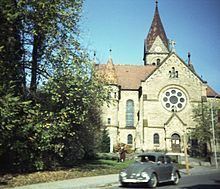
Neuendettelsau is a local authority in Middle Franconia, Germany. Neuendettelsau is situated 20 miles southwest of Nuremberg and 12 miles east of Ansbach. Population: 7,535 (as at 31 December 2013). The city has three schools. Since 1947 it has a Lutheran seminary (Augustana Hochschule). It is connected by motorway A6.
Contents
- Map of Neuendettelsau Germany
- Diakonie Neuendettelsau
- Politics
- Sister city
- Famous people
- Literature
- References
Map of Neuendettelsau, Germany
Diakonie Neuendettelsau
Reverend Wilhelm Löhe (1808–1872) founded in 1854 an institute for deaconesses. The Diakonie Neuendettelsau is one of today’s major independent Christian institutions for social welfare work in Germany and the biggest such enterprise in Bavaria. More than 5,800 employees at numerous institutions in Neuendettelsau and other regions all over Southern Germany and in other European countries take care of the people they are responsible for.