
Coat of arms Flag Towns of district significance 1 Area 1,061 km² | Rural okrugs 3 Founded 7 April 1946 | |
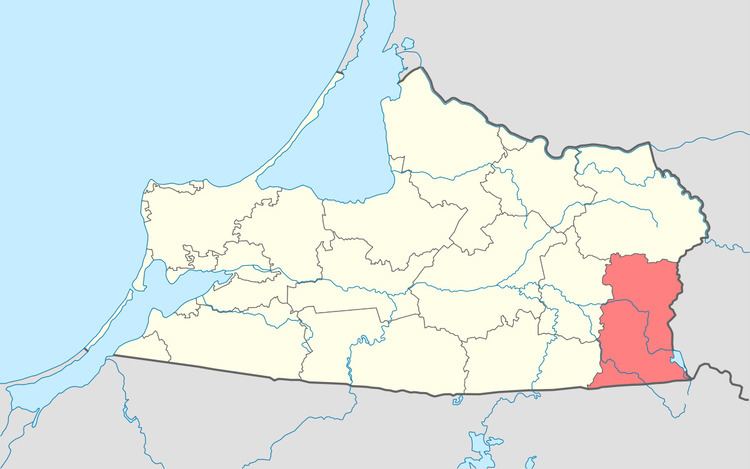 | ||
Nesterovsky District (Russian: Не́стеровский райо́н) is an administrative district (raion), one of the fifteen in Kaliningrad Oblast, Russia. As a municipal division, it is incorporated as Nesterovsky Municipal District. It is located in the southeast of the oblast and borders with Krasnoznamensky District in the north, Lithuania in the east, Poland in the south, and with Gusevsky and Ozyorsky Districts in the west. The area of the district is 1,062 square kilometers (410 sq mi). Its administrative center is the town of Nesterov. Population: 16,213 (2010 Census); 17,250 (2002 Census); 15,181 (1989 Census). The population of Nesterov accounts for 28.3% of the district's total population.
Contents
Map of Nesterovsky District, Kaliningradskaya Oblast, Russia
Border crossings
In Nesterov, there is a border railway station to Lithuania on the line from Kaliningrad to Moscow. In Chernyshevskoye, an important border crossing point on the principal road connecting Kaliningrad to Moscow is located.
Miscellaneous
Near the settlement of Yasnaya Polyana, the former stable of the Trakehner horse breed is located, as well as a museum for the breed.