
Country Kosovo Length 41 km Mouth Lepenac | Basin size 229 km (88 sq mi) Source Nerodimka | |
 | ||
Other name(s) Неродимка
Nerodimja, Nerodime Main source Nerodimka mountain, Kosovo River mouth Lepenac, at Kačanik, Kosovo | ||
The Nerodimka (Serbian Cyrillic: Неродимка; Albanian: Nerodimja, Nerodime), is a river in the Nerodimlje region of Kosovo, a 41 km-long left tributary to the Lepenac river. It represents Europe's only instance of a river bifurcation flowing into two seas, dividing into two irreversible branches. The left branch flows into the Black Sea, and the right branch flows into the Aegean Sea.
Contents
Map of Nerodimja
Another river that naturally bifurcates is the Casiquiare river in Brazil whose one arm flows into the Orinoco (and with it, into the Caribbean sea), and other arm into the Rio Negro (and with it into the Atlantic Ocean). For other cases see List of unusual drainage systems.
GeographyEdit
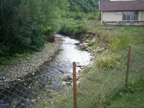
The Nerodimka river rises in the Lake Peak and is formed by two main tributaries, one flowing from the Nerodimka mountain and the other one from the Crnoljeva mountain. They join in the village of Nerodime e Epërme (Gornje Nerodimlje). From there it flows to a dam, where the first bifurcation occurs at 42.369151°N 21.080277°E / 42.369151; 21.080277. The northern branch flows into the Sitnica river and ultimately into the Black Sea via the Ibar, Morava and Danube rivers; while the main, southern branch joins with another branch of the Nerodimka river and together continue the journey to the Aegean Sea via the Lepenac and Vardar Rivers.
After the major settlement of southern Kosovo, the town of Ferizaj, the Nerodimka turns south and flows next to the villages of Varoš Selo, Kamena Glava, Stari Kačanik, Stagovo and Runjevo, before it reaches the town of Kačanik and empties into the Lepenac river.
The bifurcation is actually an artificial phenomenon, as the connection was achieved by digging an artificial canal, but the downstream water flow is still natural. In the 14th century, during the reign of king Milutin, a canal connecting the Sazlija pond and the river Nerodimka was dug, creating an artificial bifurcation, since the Nerodimka flows to the south into the Lepenac river and thus belongs to the Aegean Sea drainage basin, while the Sitnica (which is an outflow of the Sazlija) flows to the north, into the Ibar river and belongs to the Black Sea drainage basin. After World War II, the canal was covered with earth again as it was previously mudded as a result of the lack of maintenance.
These water flows have separate impact in annual temperatures of this region. The average annual temperature is 9.9 °C. Warmest months are July and August, with average temperature 18.9 °C. The coldest month is January, with an average temperature -2.6 °C. Maximum air temperature is 32.5 °C in July, while the minimum -14.0 °C in January.
Atmospheric precipitation also plays a role of abundance water in Nerodimka river. The average of rainfalls for every month is 73.3 mm. Months with the most rainfalls are April–May, 105.6 mm, while at least August with 42.2 mm.
Development strategies and protectionEdit
The bifurcation of Nerodimka is under state protection since 1979, and it is declared as a strict wildlife sanctuary, first category according to (IUCN) Official emblem of the municipality of Ferizaj contains the visual representation of the Nerodimka river bifurcation.
This phenomenon is attractive for researchers and visitors and has great importance to education, science and tourism. The western part of the city offers ideal conditions for the formation of public green spaces (parks), for the development of tourism and recreation. Branch of Nerodimka River enters within the city, extensive recreational area that is also available to residents of Uroševac bifurcation area, waterfall and the merger of the two rivers.
The Nerodimka drains an area of 229 km² itself, and it is not navigable.