
Length 177,000 m | Season All year Round | |
 | ||
Sights The valley of the River Nene | ||
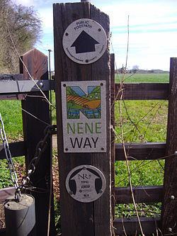
The Nene Way is a waymarked long-distance footpath in England running through the English counties of Northamptonshire, Cambridgeshire and Lincolnshire. It generally follows the course of the River Nene.
Contents
Map of Nene Way, Peterborough PE8, UK
Distance
The Nene Way runs for 177 kilometres (110 mi).
The route
The Nene Way broadly follows the course of the River Nene and starts in Badby, Northamptonshire, ending in Sutton Bridge, Lincolnshire, passing en route through Northampton town and the city of Peterborough, the market towns of Thrapston, Oundle and Whittlesey, and villages such as Fotheringay.
Attractions
The route permits walkers to explore bluebell woods in season, wildlife havens and follow in the footsteps of Mary, Queen of Scots and the poet H.E. Bates.
References
Nene Way Wikipedia(Text) CC BY-SA