Rahul Sharma (Editor)

Neighborhoods in Providence, Rhode Island

Updated on
Edit
Like
Comment
Share on FacebookTweet on TwitterShare on LinkedInShare on Reddit
Neighborhoods in Providence, Rhode Island

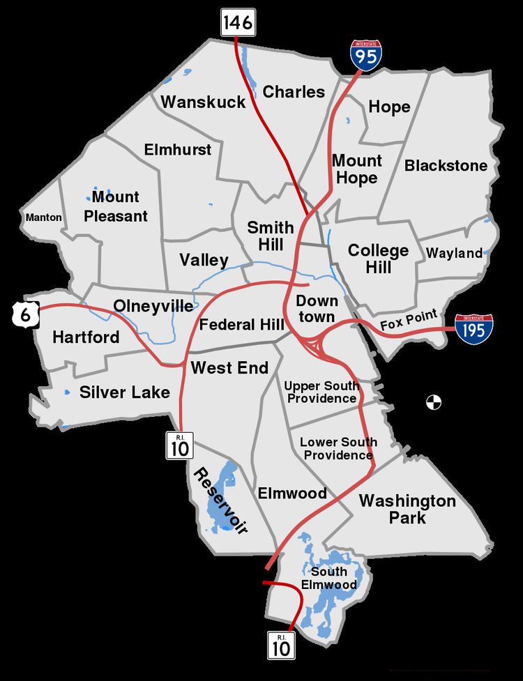
The city of Providence, Rhode Island has 25 official neighborhoods.

Map of Providence, RI, USA

Many of these neighborhoods are often grouped together referred to collectively:

  • East Side - region of Blackstone, Hope (aka Summit), Mount Hope, College Hill, Wayland, and Fox Point.
  • Jewelry District - the area around Davol Square. This area will be united with Downtown after the completion of the Iway project to move I-195 south.
  • North End - sometimes given collectively to the neighborhoods of Charles and Wanshuck.
  • South Side or South Providence - region consisting of the neighborhoods of Elmwood, Lower South Providence, Upper South Providence, and West End.
  • West Broadway - an area of Federal Hill and West End along the western portion of Westminster Street.
  • The oldest, highest density neighborhoods are either those close to downtown or proximate to the Woonasquatucket River, which provided a power source for early industrialization in Manton, Hartford, and Olneyville. More distant neighborhoods developed later, mostly as transportation as public horse car and streetcar lines were added.

    References

    Neighborhoods in Providence, Rhode Island Wikipedia