
District Ghinda Climate Cfa Population 5,000 (2005) | Elevation 1,700 m (5,500 ft) Local time Thursday 3:00 PM | |
 | ||
Weather 30°C, Wind W at 14 km/h, 20% Humidity | ||
Google earth tour eritrea debre bizen climb from nefasit
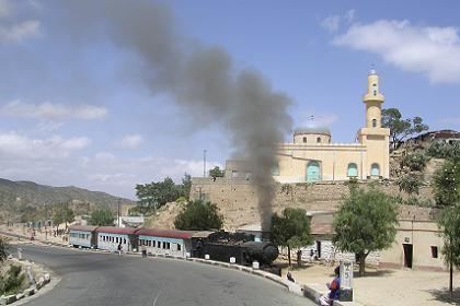
Nefasit (Tigrinya: ነፋሲት? [nɐfasit]), also known as Tappa Nefasit, is a small town in the Northern Red Sea Region of Eritrea. Monastery of Debre Bizen is located at the mountains above.
Contents
- Google earth tour eritrea debre bizen climb from nefasit
- Map of Nefasit Eritrea
- Eritrea mallets to asmara pt 2 steaming around nefasit
- References
Map of Nefasit, Eritrea
According to multiple tour groups the stretch between the capital Asmara and Nefasit is the most beautiful in Eritrea . There's a colonial era Italian railway that runs from Asmara.
Eritrea mallets to asmara pt 2 steaming around nefasit
References
Nefasit Wikipedia(Text) CC BY-SA