
Time zone Central (CST) (UTC-6) Local time Thursday 6:40 AM Population 25,501 (2010) | Elevation 750 ft (230 m) ZIP codes 54956 Zip code 54956 Area code 920 | |
 | ||
Weather -2°C, Wind S at 11 km/h, 76% Humidity | ||
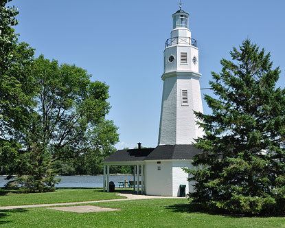
Neenah is a city in the north central United States in Winnebago County, Wisconsin. It is situated on the banks of Lake Winnebago, Little Lake Butte des Morts, and the Fox River, approximately forty miles (60 km) southwest of Green Bay.
Contents
Map of Neenah, WI 54956, USA
Neenah is bordered by the Town of Neenah, and the city is the southwestern-most of the Fox Cities of northeast Wisconsin, and is the smaller of the two principal cities of the Oshkosh-Neenah Metropolitan Statistical Area, which is included in the Appleton-Oshkosh-Neenah Combined Statistical Area.
Neenah's population was 25,501 at the 2010 census and is sometimes referred to as a twin city with Menasha, with which it shares Doty Island.
History
Neenah was named by Governor James Duane Doty for the Winnebago word for "water" or "running water". It was the site of a Ho-Chunk village in the late 18th century. It is Nįįňą in the Hoocąk language.
The area was first designated an industrial and agricultural mission to the Menominee Indians in 1835, and early settlement by Americans of European descent began a few years later, stimulated in large part by the proximity of the area to the Fox River.
A major paper mill was established here in 1873. Kimberly-Clark corporation was formed here in 1872.
Geography
Neenah is located at 44°10′26″N 88°28′6″W (44.174035, -88.468508).
According to the United States Census Bureau, the city has a total area of 9.61 square miles (24.89 km2), of which, 9.23 square miles (23.91 km2) is land and 0.38 square miles (0.98 km2) is water.
2010 census
As of the census of 2010, there were 25,501 people, 10,694 households, and 6,700 families residing in the city. The population density was 2,762.8 inhabitants per square mile (1,066.7/km2). There were 11,313 housing units at an average density of 1,225.7 per square mile (473.2/km2). The racial makeup of the city was 93.7% White, 1.3% African American, 0.7% Native American, 1.4% Asian, 1.3% from other races, and 1.5% from two or more races. Hispanic or Latino of any race were 3.8% of the population.
There were 10,694 households of which 32.2% had children under the age of 18 living with them, 47.6% were married couples living together, 10.5% had a female householder with no husband present, 4.6% had a male householder with no wife present, and 37.3% were non-families. 30.7% of all households were made up of individuals and 10.7% had someone living alone who was 65 years of age or older. The average household size was 2.36 and the average family size was 2.96.
The median age in the city was 37.1 years. 25% of residents were under the age of 18; 7.8% were between the ages of 18 and 24; 27.6% were from 25 to 44; 27% were from 45 to 64; and 12.7% were 65 years of age or older. The gender makeup of the city was 48.9% male and 51.1% female.
2000 census
As of the census of 2000, there were 24,507 people, 9,834 households and 6,578 families residing in the city. The population density was 2,971.7 people per square mile (1,146.9/km²). There were 10,198 housing units at an average density of 1,236.6 per square mile (477.3/km²). The racial makeup of the city was 96.08% White, 0.34% Black or African American, 0.55% Native American, 0.96% Asian, 0.86% from other races, and 1.20% from two or more races. 2.02% of the population were Hispanic or Latino of any race.
Thirty-five percent of the households had children under the age of 18 living with them, 53.8% were married couples living together, 9.8% had a female householder with no husband present, and 33.1% were non-families. 27.5% of all households were made up of individuals and 10.1% had someone living alone who was 65 years of age or older. The average household size was 2.47 and the average family size was 3.03.
In the city, the population was spread out with 27.5% under the age of 18, 7.6% from 18 to 24, 32.0% from 25 to 44, 20.3% from 45 to 64, and 12.5% who were 65 years of age or older. The median age was 35 years. For every 100 females there were 94.6 males. For every 100 females age 18 and over, there were 91.8 males.
The median income for a household in the city was $45,773, and the median income for a family was $55,329. Males had a median income of $39,140 versus $25,666 for females. The per capita income for the city was $24,280. About 3.3% of families and 5.4% of the population were below the poverty line, including 6.4% of those under age 18 and 7.2% of those age 65 or over.
Economy
Neenah hosts significant steel and paper industries. Some paper companies include Clearwater Paper, SCA Tissue, Kimberly-Clark and Neenah Paper. Kimberly-Clark was founded in Neenah and maintains significant operations there, though its headquarters moved to Irving, Texas, in the 1980s. Manhole covers manufactured at Neenah Foundry can be found throughout the central United States and parts of Europe. Another big company in Neenah is Prolamina.
Neenah is the headquarters of Plexus, a developer and manufacturer of electronic products, which also has engineering and manufacturing operations in the city. Also headquartered in Neenah are Cobblestone Hotel Group, Bemis Co, Inc., Miron Construction, Menasha Corporation, Theda Clark Hospital, Alcan Packaging, NM Transfer and Checker Logistics. Business process outsourcing organizations also contributed to the economy of the city.
Culture
Founded in 1959, Neenah's Bergstrom-Mahler Museum has a collection of glass art comprising over 3,000 pieces, concentrating in historic paperweights and Germanic glasswork.