
Surface area 11,200 acres (45 km) Surface elevation 155 m | Primary inflows Basin countries United States Area 45.32 km² Outflow location Coosa River | |
 | ||
Cities Gadsden, Rainbow City, Southside | ||
Alabama bass trail garmin video neely henry lake 2016
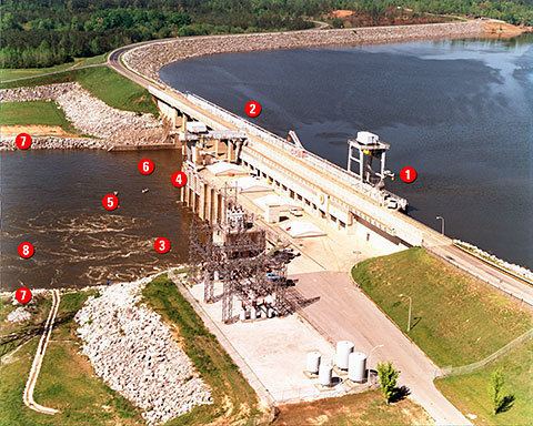
Neely Henry Lake is located on the Coosa River near Gadsden, Alabama. The lake was formed by the Neely Henry Dam (57 ft high), built in 1966 by Alabama Power Company for hydroelectric power and recreation.
Contents
- Alabama bass trail garmin video neely henry lake 2016
- Map of Neely Henry Lake Alabama 36271 USA
- Early summer bass fishing on neely henry lake
- References
Map of Neely Henry Lake, Alabama 36271, USA
Completed on June 2, 1966, the dam and reservoir were named for H. Neely Henry, a senior executive vice-president of Alabama Power. The dam has a 72,900 kilowatt generating capacity; the lake covers 11,200 surface acres (45.3 km²) with a total capacity of 129,800 acre-feet and about 339 miles of shoreline. The nearest town is Ohatchee, Alabama to the East of the dam, and Ragland, Alabama to the West. It is an excellent recreational lake with fishing opportunities for largemouth bass, spotted bass, bluegill and other sunfish, crappie, catfish, striped bass, hybrid and white bass. Alabama Power maintains three public access sites on the lake.