
Existed: 1926 – present Constructed 1926 | Length 50.71 km | |
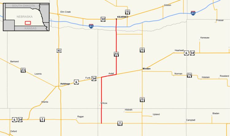 | ||
Nebraska Highway 44 is a highway in Nebraska. It runs in a south-to-north direction for 31.51 miles (50.71 km). It has a southern terminus at Nebraska Highway 4 south of Wilcox. It has a northern terminus in Kearney at an intersection with U.S. Highway 30.
Route description
Nebraska Highway 44 begins at an intersection with Nebraska Highway 4 south of Wilcox. It heads through farmland and passes through Wilcox, then meets U.S. Highway 6 and U.S. Highway 34, which are concurrent with each other. Highway 44 then turns east with U.S. 6 and U.S. 34 and passes through Axtell. East of Axtell, Highway 44 turns north. Near Kearney, Highway 44 meets Nebraska Link 50A, which serves as a link to Fort Kearny State Historical Park. Shortly after, Highway 44 crosses the Platte River and becomes a divided highway. Highway 44 then enters Kearney and meets Interstate 80. The highway continues north towards downtown Kearney on Second Avenue and ends at an intersection with U.S. Route 30.