
Length 140.9 km | ||
 | ||
Major cities | ||
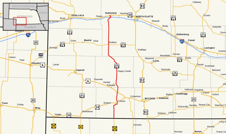
Nebraska Highway 25 is a highway in southwestern Nebraska. It runs for 87 miles (140 km). Its southern terminus is at the Kansas border south of Trenton. Its northern terminus is at U.S. Highway 30 in Sutherland.
Contents
Map of NE-25, Nebraska, USA
A previous routing of the highway is now Nebraska Highway 25A, which serves as a spur to Palisade.
Route description
Nebraska Highway 25 begins at the Kansas border and serves as a continuation of K-25. It goes north into farmland and near the Swanson Reservoir before it turns northeast to go into Trenton. In Trenton, NE 25 meets U.S. Highway 34. It continues north for 8 miles (13 km), where it meets U.S. Highway 6. It proceeds north through Hayes Center, then goes northwesterly to the border of Hayes County and Lincoln County. The highway then turns due north and meets Nebraska Highway 23 near Wallace. It continues north, meets Interstate 80 shortly before entering Sutherland, and ends in Sutherland at an intersection with U.S. Highway 30.
Highway 25A
Nebraska Highway 25A has a southern terminus in Palisade at U.S. Highway 6 and a northern terminus at Highway 25 northeast of Palisade. The highway functions as a spur route into Palisade from NE 25. The highway also previously served as an alignment of NE 25 prior to 1961. NE 25A is 6.03 miles (9.70 km) long.