
Population 565 (2011) Civil parish Neatishead Area 7.71 km² | OS grid reference TG342210 Sovereign state United Kingdom Local time Thursday 6:14 AM | |
 | ||
Weather 7°C, Wind E at 14 km/h, 90% Humidity | ||
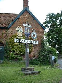
Neatishead (/ˈnitstəd/ NEET-stəd) is a village and civil parish in the English county of Norfolk. The village is situated some 20 km (12 mi) north-east of the city of Norwich, within The Norfolk Broads and to the west of Barton Broad. Access to Neatishead from the broad is by way of Limekiln Dyke, a narrow channel leading off the broad.
Map of Neatishead, UK
The civil parish has an area of 7.71 km2 (2.98 sq mi) and in the 2001 census had a population of 537 in 235 households, the population increasing to 565 at the 2011 census. For the purposes of local government, the parish falls within the district of North Norfolk.
It is famous due to the nearby RAF Neatishead radar station.
References
Neatishead Wikipedia(Text) CC BY-SA