
Area rank Ranked 11th Area 442 km² | ||
 | ||
Geocode 00NZ (ONS)W06000012 (GSS) Clubs and Teams Neath RFC, Aberavon RFC, Port Talbot Town F.C., Afan Lido F.C. Points of interest Margam Country Park, Gnoll Country Park, South Wales Miners' M, Aberdulais Falls, Cefn Coed Colliery Museum Destinations Gower Peninsula, Neath, Port Talbot, Pontardawe, Glynneath | ||
Neath Port Talbot (Welsh: Castell-nedd Port Talbot) is a county borough and one of the unitary authority areas of Wales. Neath Port Talbot is the eighth most populous local authority area in Wales and the third most populous county borough. The actual population taken at the 2011 census was 139,812. The coastal areas are mainly English-speaking, however there are many Welsh-speaking communities in the Valleys to the north of the borough.
Contents
- Map of Neath Port Talbot UK
- Neath port talbot mountain biking
- Geography
- Demographics
- Government and politics
- Local Government
- Welsh politics
- United Kingdom politics
- Economy and Industry
- Education
- Media
- Twin towns
- Places of interest
- References
Map of Neath Port Talbot, UK
The county borough borders the other principal areas of Bridgend and Rhondda Cynon Taff to the east, Powys and Carmarthenshire to the north and Swansea to the west. Its principal towns are Neath, Port Talbot and Pontardawe.
Neath port talbot mountain biking
Geography
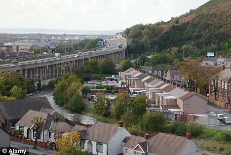
The local authority area stretches from the coast to the borders of the Brecon Beacons National Park. The majority of land is upland or semi-upland in character, and 43% is covered by forestry with major conifer plantations in upland areas. Most of the lower lying flat land is near the coast around Port Talbot. An extensive dune system stretches along much of the coast, broken by river mouths and areas of development. The upland areas are cut by five valleys: Vale of Neath, Dulais Valley, Afan Valley, Swansea Valley, Upper Amman Valley.
Modern settlement patterns reflect the industrial history of the area, with urban development along the flatter areas of the valleys and some parts of the coast. The largest town is Neath with a population of 47,020, followed by Port Talbot (35,633), Briton Ferry (7,186), Pontardawe (5,035), and Glynneath (4,368). The majority of the population live in the coastal plain around Port Talbot and the land around the River Neath in the vicinity of Neath. Much of the larger towns in the borough lie within the Swansea Urban Area.
Demographics
The population in the region reached its peak in the 1930s. Census figures show a population of 151,563 in 1931. The population has shown a steady decline throughout the rest of the 20th century. The population stood at 134,471 in 2001. In the 1990s, most areas within the region showed a fall or little change in population with the notable exception of Bryncoch South and Margam where the population grew by 47.29% and 41.36% respectively. Local council estimates show the population to have grown during the 2000s.
Government and politics
Neath Port Talbot was created from the former districts of Neath, Port Talbot and part of Lliw Valley on 1 April 1996 as Neath and Port Talbot; it changed its name on the following day, 2 April 1996. At the time of the reorganization, many local people expected that Neath and Port Talbot districts would become separate unitary authorities, and there were protests when the new authority was announced.
Local Government
The whole of the Neath Port Talbot area was once part of the county of West Glamorgan, which in turn was part of the historic county of Glamorgan. Since local government re-organisation in 1996, Neath Port Talbot is governed by Neath Port Talbot County Borough Council.
Neath Port Talbot is a staunch Labour stronghold, who have been in power since the authority's formation in 1996.
Welsh politics
The unitary authority contains two whole constituencies which are:
United Kingdom politics
Economy and Industry
In 1991 Neath & Port Talbot was a distinct Travel to Work Area (albeit with different boundaries to the current county borough), but the 2001-based revision has merged the locality into a wider Swansea Bay Travel to Work Area.
In June 2008, the economic activity and employment rates in Neath Port Talbot were below the Welsh average. However, earnings for full-time workers were higher than either the Welsh or British average.
Manufacturing accounts for over 22% of jobs in the county borough compared to under than 14% in Wales as a whole; just under 70% of local jobs are in services compared to a Welsh average of nearly 80%. Tata is the largest employer with approximately 3,000 staff (although in 1979 its predecessor employed 12,600); other large employers include General Electric, Hi-Lex Cable Systems Ltd, TRW Steering Systems recently closed, Envases (UK) Ltd, Crown Food UK & Ireland, Toyoda Koki, Sofidel, Cornelius Electronics, Excel Electronics Assemblies, and Tedeco.
Port Talbot is also the site for Neath Port Talbot Hospital which is situated on Baglan Way, Port Talbot. The current Head of Operations is Fiona Reynolds. The Switchboard is for the hospital is 01639862000.
Facilities at the hospital include:
Education
The local Neath Port Talbot Council is the education authority in the area which operates primary schools and secondary schools within the county. The local education authority operates 6 infant schools, 6 junior schools, 56 primary schools, 11 secondary schools and 3 special schools.
Further Education in Neath Port Talbot is provided by a range of institutions. St. Joseph’s Catholic School & Sixth Form Centre in Port Talbot and Ysgol Gyfun Ystalyfera have traditional sixth form settings. NPTC Group operates from several sites within the county borough. The largest sites are located in Neath, Port Talbot and Pontardawe.
The first dedicated higher education site in Neath Port Talbot opened in 2015 when Swansea University opened its science and innovation campus in Crymlyn Burrows.
The University of South Wales has a campus located at Baglan Energy Park in Port Talbot. The Baglan campus houses a Renewable Hydrogen Research and Development Centre.
Media
A separate daily edition of the South Wales Evening Post is published for the Neath Port Talbot area. The paper's publisher, South West Wales Publications, also produces a free weekly paper, the Neath & Port Talbot Tribune. The local council publishes a quarterly, Community Spirit, produced and funded in conjunction with seven other public sector partners.
Community radio station is XS broadcasts to both Neath (97.4) and Port Talbot (107.9). Nation Radio briefly broadcast to the wider South Wales region from studios in Neath, but is now based in Cardiff. The county borough is within the local commercial radio licence areas for the CHR-formatted station 96.4 The Wave, its Soft Adult Contemporary sister station Swansea Sound and the Adult Contemporary-orientated Swansea Bay Radio.
Twin towns
Neath Port Talbot was twinned with:
In 2015, Neath Port Talbot terminated all its twin city relationships for financial reasons.