
Country United States Time zone CST (UTC-6) Asian population 14.8% Black population 30.2% | State Illinois City Chicago Area 14.89 km² Hispanic population 10.3% Population 61,768 (2015) | |
 | ||
ZIP Codes parts of 60606, 60607, 60608, 60610, 60612 and 60661 Restaurants Girl & The Goat, Au Cheval, Duck Duck Goat, Little Goat Diner, Swift & Sons Hotels Soho House Chicago, Crowne Plaza Chicago, Hampton Inn Chicago, Hotel Chicago, Holiday Inn & Suites Chicago | ||
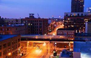
The Near West Side , one of the 77 community areas of Chicago, is on the West Side, west of the Chicago River and adjacent to the Loop. The history of the Near West Side of Chicago includes the founding of Hull House, a prominent settlement house. The Great Chicago Fire started in the Near West Side. The area is home to the University of Illinois at Chicago (UIC), the United Center and the Illinois Medical District.
Contents
- Map of Near West Side Chicago IL USA
- Fulton River District
- Greektown
- Little Italy
- University VillageMaxwell Street
- South Water Market
- Illinois Medical District
- Tri Taylor
- United Center Area
- West Loop
- Landmarks
- Government
- Transportation
- Economy
- Education
- Diplomatic missions
- References
Map of Near West Side, Chicago, IL, USA
Fulton River District
The Fulton River District makes up the north east area of the Near West Side, just west of the Loop. It is bordered by the Chicago River to the east, Ohio Street on the north, Madison Street to the south, and the Kennedy Expressway to the west. The Fulton River District is a former manufacturing and current transportation corridor turned residential neighborhood. The neighborhood is made up of warehouses that have been converted to loft condominiums, new construction high rise condominiums and apartments, high rise and mid rise business offices, retail and restaurants. The Fulton River District is the home of Boeing, and the Ogilvie Transportation Center (formerly Chicago & North Western Station), a major commuter rail terminal. The neighborhood is known for the aroma of chocolate emanating from the Blommer Chocolate Company.
Greektown
Greektown is a restaurant and nightlife corridor along Halsted Street between Van Buren and Madison Streets. It was popularized in the movie "My Big Fat Greek Wedding," which was actually filmed mostly in Toronto. Formerly part of a larger Greek neighborhood called 'The Delta'. the area home of many Greek restaurants.
Little Italy
The neighborhood between the Illinois Medical District and UIC's east campus is known as Little Italy. An Italian community developed in the late nineteenth century. Italians never actually constituted a majority in the polyglot area, but the neighborhood is still home to several Italian-American landmarks, such as the Shrine of Our Lady of Pompei and the National Italian American Sports Hall of Fame, as well as Italian-American social clubs. Taylor Street is home to the Italian restaurants Rosebud, Francesca's, Pompei and Al's No. 1 Italian Beef. There are other schools in this neighborhood. For example, Village Leadership Academy (VLA).
Part of the Italian-American population of the neighborhood was displaced in the 1960s and 70s by the construction of UIC's east campus. The university is the source of the newer name for the area.
The 1980 novel Paper Fish by Tina De Rosa takes place in this community.
University Village/Maxwell Street
Located 5 minutes from the Loop, University Village is a vibrant neighborhood consisting of residential and retail properties. University Village, along with other major developments such as University Commons and University Station is conveniently located near the University of Illinois at Chicago (UIC) campus, the medical district, Chicago's fabled Maxwell Street, and downtown Chicago.
The blocks around the intersection of Maxwell and Halsted Streets, the heart of University Village, once served as a weekly outdoor market. The area was also a center in the development of the Chicago Blues in the mid-twentieth century. The Market was moved twice in the 1990s and 2000s, and continues on Des Plaines Street. In the 2000s, UIC led a redevelopment of the area, which included new dormitories, parking garages, commercial buildings, and housing.
The borders are 16th Street to the south, the Dan Ryan Expressway to the east, Racine to the west, and Harrison Street to the north. Taylor Street is part of University Village.
South Water Market
Chicago's original produce market sat along the south side of the Chicago River, west of what is now Michigan Ave. Incoming vessels could bring fruits and vegetables from the states located around the Great Lakes. This market became known as South Water Market because of its location.
By the 1920s, the market was congested and overcrowded. The City of Chicago built new streets parallel to the Chicago River and moved the market to the neighborhood, alongside the St. Charles Air Line. The three-story buildings were originally designed by the architects Fugard & Knapp.
On July 10, 2003, The Chicago Planning Commission granted their approval on the sale of the produce market for a cost of approximately $36 million to Enterprise Companies of Chicago redevelop into retail and housing.
Illinois Medical District
The Illinois Medical District is one of the largest medical districts in the United States, and the largest in the state. John H. Stroger Jr. Hospital of Cook County (formerly known as Cook County Hospital), one of the largest county-run hospitals in the U.S. and inspiration for the TV shows ER and The Fugitive, is located here. The District had its start in the 1870s when Cook County Hospital, Rush Medical College, and the College of Physicians and Surgeons were established on the Near West Side following the great Chicago fire of 1871. The cornerstone for the Medical Center was the building of Cook County Hospital in 1876. In 1877, Rush Medical College erected a building next to County at Harrison and Wood. Presbyterian Hospital (affiliated with Rush) was built in 1883. The University of Illinois at Chicago's origins in the District can be traced to the College of Physicians and Surgeons, founded in 1881. In 1917, the State acquired the vacated West Side Park located at Polk and Wolcott for the University.
The district is also home to University of Illinois Medical Center, Rush University Medical Center, Rush University, University of Illinois College of Medicine, UIC Eye & Ear Infirmary, UIC College of Dentistry, UIC College of Pharmacy, Jesse Brown VA, The Neuropsychiatric Institute, Rothstein CORE Center, Chicago Lighthouse for the Blind & Visually Impaired, Illinois Forensic Science Center, West Side CDC, the Chicago Children's Advocacy Center, Chicago Dept. of Public Health and the Cook County Coroner's Office.
Tri-Taylor
Tri-Taylor, the western end of Taylor Street's Little Italy, consists of the roughly triangular area bordered by Congress Parkway to the North, Ogden Avenue to the East, Roosevelt Road on the south and railroad tracks on the west. The neighborhood is traditionally an extension of the Little Italy neighborhood to its east, although it has consistently been one of the most diverse neighborhoods in Chicago as it was situated on the borders of African American, Irish, Hispanic, and Italian areas. It is a residential area for students from UIC. The neighborhood is also home to the Chicago Technology Park research center as well as the West Side Center for Disease Control, the office for the Medical Examiner of Cook County, and Chicago Hope Academy (a private Christian high school that opened in the former St. Callistus School in 2005).
United Center Area
The United Center opened its doors in 1994, replacing Chicago Stadium, which was located across Madison St. The United Center is the home arena for the Chicago Bulls and Blackhawks, and also occasionally hosts concerts and other special events. The venue can seat between 20,000 and 25,000 people, depending on the event. A statue of Michael Jordan sits in front of the arena.
West Loop
The West Loop lies along the western bank of the Chicago River. It is approximately bounded by Grand Avenue on the north, Ashland Avenue on the west, the Eisenhower Expressway on the south, and the Chicago River on the east. Popular restaurants line Randolph Street, including Girl and the Goat by Stephanie Izard, and Leña Brava by Rick Bayless. The area has experienced rapid gentrification and is a haven for young families.
A former manufacturing and warehousing area, many of the buildings have been converted to loft condominiums, restaurants, night clubs, and art galleries. It is the former home of Harpo Studios, owned by well-known talk show host Oprah Winfrey, and the production site of her syndicated television show. On Monday January 4, 2016, Harpo Studios signs were taken down; the site is currently under construction to be the corporate headquarters of McDonald's.
Landmarks
Designated Chicago Landmarks in the Near West Side include:
Government
The United States Postal Service (USPS) operates the main Chicago Post Office at 433 West Harrison Street in the Near West Side. The post office is the only 24-hour post office in the United States. USPS also operates the Nancy B. Jefferson Post Office at 116 South Western Avenue.
The Federal Bureau of Investigation Chicago Field Office is at 2111 W. Roosevelt Road.
Transportation
Interstates 290 and 90 both run through the Near West Side. Their interchange is a major transportation hub for the region. The southern and western boundaries of the area are defined by busy rail-road tracks. The St. Charles Air Line, at the area's southern edge is also a major passenger train route.
The area is served by the Blue, Green, Pink 'L' lines, as well as many CTA bus routes. Union and Ogilvie stations, major terminals for Metra and Amtrak trains, are on the eastern edge of the Near West Side.
Economy
Boeing operates its headquarters at 100 North Riverside. Boeing moved into the facility, formerly the headquarters of Morton Salt, in 2001. Orbitz has its headquarters in the Citigroup Center in the Near West Side.
McDonald's plans to move its headquarters to West Loop in 2018.
PepsiCo's Chicago offices are in the Near West Side. Aeroméxico operates the Chicago Downtown Location on the first floor at 954 West Washington Boulevard.
Previously Trizec Corporation's headquarters and Chicago-area offices were in 10 S. Riverside Plaza.
Education
Chicago Public Schools (CPS) operates public schools.
K-8 schools serving the Near West Side include W. Brown, Calhoun North, Dett, Herbert, Washington Irving, King, Mitchell, Otis, Plamondon, Skinner, and Smyth.
Crane High School previously served as the zoned high school for the Near West Side. CPS announced in 2012 that Crane was to be converted into a magnet school for medical sciences.
Washington Irving School is located in Tri-Taylor. In the 2000-2001 school year, of the area children who attended CPS schools (the figure does not include those who attended private schools nor charter schools), 69% attended Irving. By the 2013-2014 school year this declined to 46%, and Linda Lutton of WBEZ stated that Irving "is largely ignored by the families who live here." As of that school year, 80% of Irving students originated from outside of the school's attendance zone, and according to Lutton it was "a neighborhood school in name only."
Moses Montefiore Academy, a CPS special school for at-risk youth, is located in the Near West Side.
Diplomatic missions
The Consulate-General of Mexico in Chicago is located at 204 South Ashland Avenue.