
- right Dâmbovnic, Câlniștea Length 186 km Source Romania | - location Comana Basin area 3,720 km² Country Romania | |
 | ||
Mouths Călugăreni, Giurgiu, Argeș, Argeș County | ||
The Neajlov is a river in Romania. It is a right tributary of the river Argeș, which it meets near Comana, Giurgiu County. It rises from the Getic plateau. It is 188 km (117 mi) long and its basin area is 3,718.5 km2 (1,435.7 sq mi).
Contents
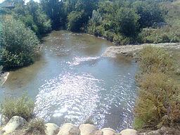
Map of Neajlov River, Romania
LocationEdit
The river basin is located in the southern part of Romania, the geographic position being 24°51’12”-26°13’52” E longitude and 43°55’31”-44°49’32” N latitude.
Towns and villagesEdit
The following towns and villages are situated along the river Neajlov, from source to mouth: Oarja, Morteni, Petrești, Uliești, Corbii Mari, Vânătorii Mici, Crevedia Mare, Clejani, Bulbucata, Iepurești, Singureni, Călugăreni, Comana.
TributariesEdit
The following rivers are tributaries to the river Neajlov:
Left: Glonț, Teiș, Neajlovel, Neajlovel, Izvor, Izvorul Dealului, Ilfovăț, Bătrâna, Stătoaica
Right: Valea Adâncă, Cristia, Holboca, Baracu, Chiricanu, Dâmbovnic, Bălăria, Câlniștea, Țânțăroasa, Buda, Dadilovăț, Gurban
LakesEdit
Comana