
Length 36 km Mouth elevation 0 | Basin area 227 km² | |
 | ||
Main source Inste Langevatnet1,390 metres (4,560 ft) Basin size 227 square kilometres (88 sq mi) | ||
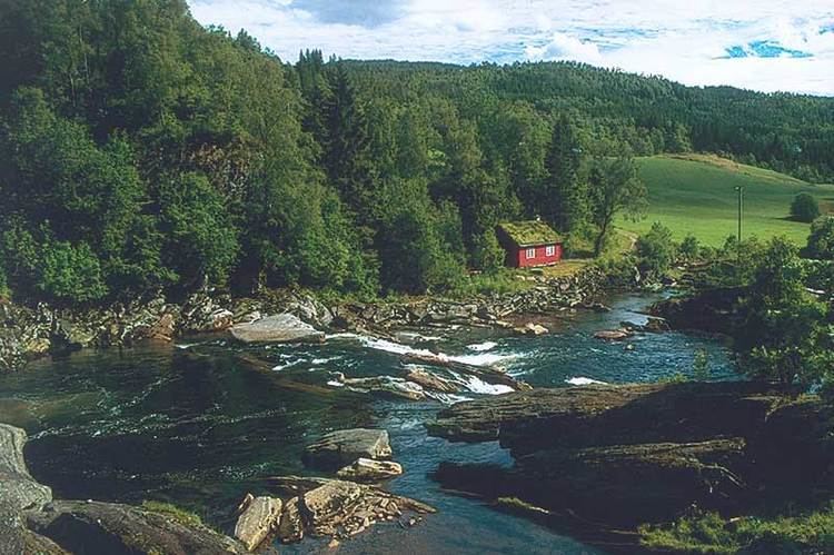
Nausta is a river in Naustdal Municipality in Sogn og Fjordane county, Norway. It runs through the Naustdal valley to the southwest before emptying into Førde Fjord at the village of Naustdal below Kletten Hill. The 36-kilometre (22 mi) long river drains a watershed area of about 276 square kilometres (107 sq mi). The river begins at the lake Inste Langevatnet, which sits high up in the mountains at an elevation of 1,390 metres (4,560 ft) above sea level.
Contents
Map of Nausta, Naustdal, Norway
Salmon and sea trout fishing
The Nausta is a small and medium-sized salmon river. From the old bridge across the Naustdalsfossen waterfall salmon may be observed climbing the falls. Fishing permits may be purchased at the local petrol station or from local landowners. In 2005, the river Nausta was ranked as the best in Sogn og Fjordane county and number 19th nationally with a total catch of 4,698 kilograms (10,357 lb).
Salmon travel 12 kilometres (7.5 mi) upstream from the river mouth. The stretch from the fjord to the Hovefoss waterfall is also good for sea trout fishing. The small Redal water system contains small salmon, sea trout, trout and char. Small salmon and sea trout are best caught during floods.
Fishing season
The salmon and sea trout season runs from 1 June until 31 August each year. The landowners have set a limit of catching one salmon under 2.5 kilograms (5.5 lb) per day.
Catch statistics
The record for the largest fish caught in the river Nausta was set in 1946, when a salmon weighing 23.6 kilograms (52 lb) was caught.