Discharge 16.3 m³/s | Basin area 939 km² | |
 | ||
Tsunami hits natori river near sendai
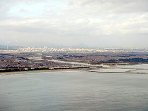
The Natori River is a river in the northeastern part of Japan. The river's headwaters start in the Zao Mountain range, it flows through the Sendai Plain and ends by draining into Sendai Bay. The river's estuary is located on Japan's east coast, and faces the Pacific Ocean. The river's flow is the greatest during the snow melt season from March – April, the rainy season from June – July and during the typhoon season from September – October. The river's length is 55 km, and its tributaries are the Hirose, Masuda and Goishi Rivers. The Natori provides water for 1 million people in Sendai.
Contents
- Tsunami hits natori river near sendai
- Natori river tsunami earthquake in japan mp4
- Basin
- Natori gawa river system
- References
Natori river tsunami earthquake in japan mp4
Basin
The river's basin has two primary reservoirs, the Okura dam reservoir and the Kamafusa Dam reservoir, both of which serve as regulators of flood control and for the supply of water. In the event of the river flooding, the dams serve to control and reduce water flow to lower basins.
Natori-gawa river system
The river exists within the Natori-gawa river system, which exists between the coordinates N 38° 08' to 38° 37' and E 140° 26' to 140° 58. The overall Natori-gawa river system's area is 939 km2
