
Length 58 km | ||
 | ||
N end: 31 kilometres (19 mi) E of Ituzaingó | ||
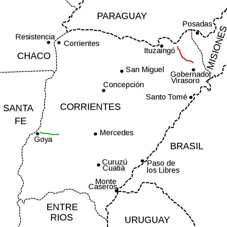
National Route 120 is a national road in Argentina, running NW in Corrientes. It starts at the joining with National Route 14, 9 kilometres (6 mi) north of the town of Gobernador Virasoro and runs for 58 kilometres (36 mi) until it connects to National Route 12 31 kilometres (19 mi) east of Ituzaingó. The road is marked in red in the map. Previously this road was known as Provincial Route 38 and changed to national jurisdiction in an agreement between Dirección Nacional de Vialidad and the provincial transport authorities, signed by Law # 5152 of Corrientes Province on 3 April 1997
Contents
Map of RN120, Corrientes, Argentina
The whole length of the road is within Corrientes Province, crossing through Santo Tomé Department and Ituzaingó Department.
Old road
In previous times there was a road with this number on the West of Corrientes Province. With a length of 45 kilometres (28 mi), it ran eastwards from the city of Goya. Today this older road is part of National Route 12. This section is marked in green on the map.