
Country Argentina Time zone ART (UTC-3) Dialing code +54 3756 Area 2,100 km² Local time Wednesday 7:38 PM | Department Santo Tomé CPA base W3342 Elevation 127 m | |
 | ||
Weather 24°C, Wind NE at 6 km/h, 90% Humidity | ||
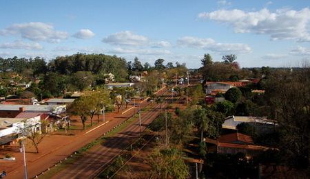
Gobernador Virasoro (formally Gobernador Ingeniero Valentín Virasoro) is a city in the province of Corrientes in the Argentine Mesopotamia. It had about 29,000 inhabitants at the 2001 census .
Map of Gobernador Virasoro, Corrientes Province, Argentina
The city lies in the north-east of the province, 64 km north from the city of Santo Tomé and 90 km from Posadas, Misiones, on National Route 14. The Iberá Wetlands are located 80 km to the west.
Gobernador Virasoro as such was founded on 23 September 1926. The original settlement, called Villa Vuelta del Ombú since the time the Jesuits established a ranch there, was renamed in homage to Valentín Virasoro, a field engineer who measured terrains and studied the Iberá lagoon and wetlands working for the provincial government.
References
Gobernador Virasoro Wikipedia(Text) CC BY-SA