
Length 196 km | North end: Paraje Vallejos Cué | |
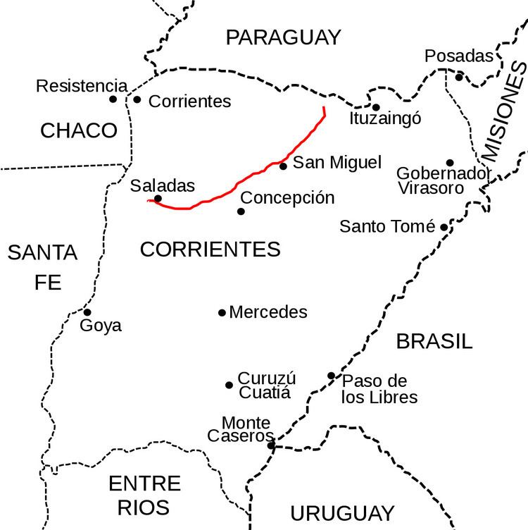 | ||
National Route 118 is a national road in Argentina, in the northwest of Corrientes Province. It starts at the junction with National Route 12 until reaching the rural area of Paraje Vallejos Cué for a total length of 196 kilometres (122 mi). The road is marked in red in the map.
Contents
Map of RN118, Corrientes, Argentina
Cities
The whole length of the road is within Corrientes Province, crossing through the following Departments and cities (over 5,000 people):
History
Originally this road was called National Route 117. By Decree #1595 of 1979, it was ceded to the administration of Corrientes Province. Decree 1715 from 1988 annuls the previous decree and this road became National Route 118 as number 117 had been used on another road near Paso de los Libres in the SE of the province.
References
National Route 118 (Argentina) Wikipedia(Text) CC BY-SA