
Founded July 7, 1868 Elevation 66 ft (20 m) Local time Tuesday 6:17 AM | County San Diego Incorporated September 17, 1887 Zip code 91950 Population 59,834 (2013) | |
 | ||
Weather 13°C, Wind E at 10 km/h, 82% Humidity Colleges and Universities Bellus Academy National City, Bay Vista College of Beauty | ||
Triangular shaped ufo with glowing lights over national city california san diego findingufo
National City is a city located in the South Bay region of the San Diego metropolitan area, in southwestern San Diego County, California.
Contents
- Triangular shaped ufo with glowing lights over national city california san diego findingufo
- Map of National City CA USA
- History
- Geography
- Communities
- Climate
- Ecology
- 2010
- 2000
- Crime
- Tourism
- Top employers
- Museums and other points of interest
- Community events
- Government
- Education
- Immigrant sanctuary
- Notable people
- In popular culture
- Sister cities
- References
Map of National City, CA, USA
The population was 58,582 at the 2010 census, up from 54,260 at the 2000 census. National City is the second-oldest city in San Diego County.
History
For thousands of years, the Kumeyaay people, also known as Tipai-Ipai and later Diegeño, lived peacefully and prospered in San Diego County's moderate climate. The area known as National City today was part of the Kumeyaay's ancestral territory which ranged east to El Centro, north to Escondido, and south into Baja California. The Kumeyaay were skilled hunters and innovative agriculturists. The Kumeyaay established their rich cultural identity and traditions, many of which are still practiced and honored today. The Kumeyaay first encountered Europeans with the arrival of Juan Rodriguez Cabrillo in 1542 in what is now San Diego. By the year 1769, when Spanish soldiers and missionaries, led by Father Junipero Serra, founded the Mission San Diego de Alcalá and the Presidio of San Diego, the destruction of the Kumeyaay way of life had irreversibly begun. By the late 18th century, Spaniards entered Tipai-Ipai (Kumeyaay) territory, bringing with them non-native, invasive flora, and domestic animals like horses and cattle, which brought about degradation to local ecology.
The Spanish named the 26,000 acres (11,000 ha) of land El Rancho del Rey (the Ranch of the King), used by Spanish soldiers to graze horses. After independence from Spain, in 1810, the Mexican government renamed it Rancho de la Nación (Ranch of the Nation). Governor Pío Pico granted Rancho de la Nación to his brother-in-law John (Don Juan) Forster in 1845. President Andrew Johnson, in issuing the land patent, listed the name as simply "The National Ranch", the English translation of the land grant name, "Rancho de la Nacion".
In 1868, Frank Kimball and his brothers Warren and Levi, contractors and builders from San Francisco, purchased the entire rancho and thus began the foundation of the city, retaining the National name.
Frank Kimball first brought novelty and change to the area by building his personal residence. His home included a bathtub as well as hot, running water, making it the first modern house in the entire county. However, it was more than his personal innovative endeavors that allowed the region to flourish. By constructing the first roads and railroad in what is now National City, Frank and his brothers most notably were responsible for introducing modern transportation to the residents of the community. The brothers also implemented the area’s first post office and a wharf for sea-bound imports and exports. These large ventures, coupled with smaller personal missions, both contributed to the overall goal of creating a community unparalleled to the times. A lasting mark of the Kimballs was the trees they imported and planted from Europe and Asia, accomplished via a partnership with the U.S. Department of Agriculture. These trees can be found dotted throughout the city to this very day. It was the passion and influence of the Kimballs as well as other early pioneers that made way for the city’s incorporation on September 17, 1887.
Geography
National City is located at 32°40′15″N 117°5′34″W (32.670903, -117.092725).
According to the United States Census Bureau, the city has a total area of 9.1 square miles (24 km2). 7.3 square miles (19 km2) of it is land and 1.8 square miles (4.7 km2) of it (20.17%) is water. National City is bounded by San Diego to the north and northeast, Bonita to the southeast, and Chula Vista to the south across the Sweetwater River. San Diego Bay lies to the immediate west of the city. Also, within the boundaries of National City on the eastern side of town is the unincorporated area of San Diego County known as Lincoln Acres. National City is 15 minutes away from the US–Mexico Border (Tijuana).
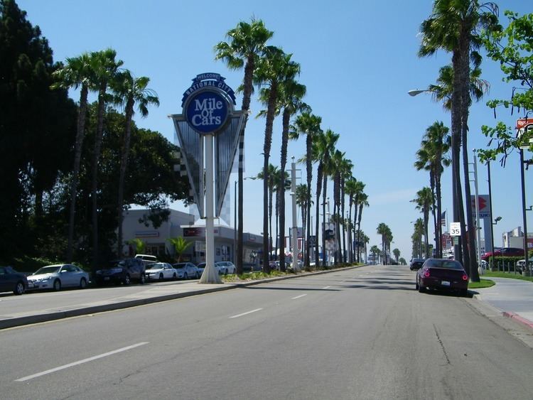
National City has road access by the Interstate 5, Interstate 805, and California State Route 54, in addition to surface streets. National City Blvd, which once served as part of the historic U.S. Route 101, still serves as a north–south arterial street parallel to Highland Ave. Plaza Blvd and 30th Street/Sweetwater Road serve as east–west arterial routes. It has rail access through the San Diego Trolley's Blue Line. The nearest commercial airport is San Diego International Airport.
In 2012, National City was honored as the most walkable city in San Diego County. It currently holds a walk score of 71, among the highest scores for cities of similar size. However, its current score also puts National City among bigger cities like Seattle, Washington (74) and Portland, Oregon (66). San Diego's current walk score is 56.
Communities
Although there are no specific communities identified by the city of National City, certain areas have self-identified as communities. The Old Town community is virtually bordered by McKinley Ave (to the west)and National City Blvd (to the east), and 24th street (to the south) and 8th street (to the north). While Lincoln Acres is an unincorporated area of San Diego County, it is located wholly within the boundaries of the incorporated city of National City and both share the postal code (91950). The South Port Business Center, an industrial park in which many businesses operate, is bordered by I-5 to the west, National City Blvd to the east Mile of Cars Way (24th street)to the north, and W 28th street to the south. The residents near Las Palmas and El Toyon parks have neighborhood councils where they can voice their concerns with the city's elected officials.
The Neighborhood Council Program was developed in an effort to improve communication with the community and to bring services directly to National City residents. The program helps to unify neighbors to further enhance the image of ther city, instilling civic pride into neighborhoods. Regular monthly meetings are held in each of the three Neighborhood Councils. Agenda topics are driven by resident requests, current events, and a desire by city officials to keep residents abreast of new programs and upcoming developments. Meetings are usually attended by police and fire officials, as well as members of the City Council.
Besides attending regular meetings, Neighborhood Council participants assist the city in improving their neighborhoods by volunteering during clean-up and beautification events and by helping to reduce crime. Residents also participate in family events sponsored by the Neighborhood Council Program such as National Night Out and Movies in the Park, as well as other city-sponsored events.
Climate
National City’s climate is characterized by warm, dry summers and mild winters, with most of the annual precipitation falling between December and March. The city has a mild climate year-round, with an average of 201 days above 72 °F (22 °C) and low rainfall (9–13 inches [23–33 cm] annually). Frequently, particularly during the “May gray/June gloom” period, a thick “marine layer” cloud cover will keep the air cool and damp within a few miles of the coast.
On average, the warmest month is August. The highest recorded temperature was 108 °F in September 1988. On average, the coolest month is December. The lowest recorded temperature was 15 °F in April 2003. The maximum average precipitation occurs in February.
Ecology
Like most of Southern California and the San Diego County region, the majority of National City's current area was originally occupied by chaparral, a plant community made up mostly of drought-resistant shrubs. National City's broad city limits encompass the San Diego National Wildlife Refuge and the most northern area of the Sweetwater Marsh National Wildlife Refuge. The Sweetwater River runs from the Cuyamaca Mountains, through National City and Chula Vista via a flood control channel (natural route as opposed to a canal) and empties into the San Diego Bay. Most of west National City is flat with an average elevation of 72 feet (22 m), which made it historically desirable and well suited for the Spanish to graze their horses. The eastern areas of National City tend to have canyons and ridges with an existing wildlife.
2010
The 2010 United States Census reported that National City had a population of 58,582. The population density was 6,426.7 people per square mile (2,481.4/km²). The racial makeup of National City was 24,725 (42.2%) White, 3,054 (5.2%) African American, 618 (1.1%) Native American, 10,699 (18.3%) Asian, 482 (0.8%) Pacific Islander, 16,175 (27.6%) from other races, and 2,829 (4.8%) from two or more races. Hispanic or Latino of any race were 36,911 persons (63.0%).
The Census reported that 52,830 people (90.2% of the population) lived in households, 5,341 (9.1%) lived in non-institutionalized group quarters, and 411 (0.7%) were institutionalized.
There were 15,502 households, out of which 7,402 (47.7%) had children under the age of 18 living in them, 7,376 (47.6%) were opposite-sex married couples living together, 3,437 (22.2%) had a female householder with no husband present, 1,300 (8.4%) had a male householder with no wife present. There were 959 (6.2%) unmarried opposite-sex partnerships, and 83 (0.5%) same-sex married couples or partnerships. 2,694 households (17.4%) were made up of individuals and 1,226 (7.9%) had someone living alone who was 65 years of age or older. The average household size was 3.41. There were 12,113 families (78.1% of all households); the average family size was 3.79.
The population was spread out with 14,939 people (25.5%) under the age of 18, 9,472 people (16.2%) aged 18 to 24, 15,892 people (27.1%) aged 25 to 44, 12,076 people (20.6%) aged 45 to 64, and 6,203 people (10.6%) who were 65 years of age or older. The median age was 30.2 years. For every 100 females there were 105.5 males. For every 100 females age 18 and over, there were 106.5 males.
There were 16,762 housing units at an average density of 1,838.9 per square mile (710.0/km²), of which 5,197 (33.5%) were owner-occupied, and 10,305 (66.5%) were occupied by renters. The homeowner vacancy rate was 2.1%; the rental vacancy rate was 5.6%. 19,165 people (32.7% of the population) lived in owner-occupied housing units and 33,665 people (57.5%) lived in rental housing units.
2000
As of the census of 2000, there were 54,260 people, 15,018 households, and 11,804 families residing in the city.
As of 2007, 19.5% of National City residents have incomes listed below the poverty level, a figure above the 12.4% California state average. In 2000, the estimated household income was $29,826. As of 2009, the estimated household income is $39,158, which is below the California state average of $59,958.
Crime
Although crime has dropped since the 1980s and 1990s, National City still has significant gang and drug activity, and perennially leads San Diego County in violent crime.
For example, the number of violent crimes recorded by the FBI in 2003 was 546. The number of homicides for that year was 9, a rate of 16.6 per 100,000 people and three times the national average of 5.5. The violent crime rate was 9.7 per 1,000 people. From 2003 to 2007, National City averaged 5.2 homicides a year or an average rate of 9.6 per 100,000 people.
In 2008, National City was homicide-free for the first time since 1963, though it still led San Diego County in violent crime with a rate of 6.1 per 1,000 people (the county average was 3.9 per 1,000 for that year).
Tourism
With tourism being a major industry in San Diego County, in January 2012, the National City Chamber of Commerce and National City lodging businesses formed the National City Tourism Marketing District as a benefit assessment district to help fund marketing and sales promotion efforts for city lodging businesses. The NCTMD includes all lodging business (hotels, motels and inns), existing and in the future, available for public occupancy located within the city limits boundaries. These include the Best Western Marina Gateway, Carlill Auto Court, Clarion South Bay, Grand Plaza Inn, Holiday Inn Express Howard Johnson Express, National City Motel, Paradise Motel, Rodeway Inn, Stardust Inn, Super 8 Motel and Sweetwater Inn. An annual assessment of 2.5% of gross short-term room rental revenue collected by lodging business goes to fund the NCTMD and its activities of promoting the safety and enhanced image of National City in order to increase tourism as well as to market National City as a tourist, meeting and event destination.
Top employers
According to the city's 2010 Comprehensive Annual Financial Report, the top employers in the city are:
Museums and other points of interest
Community events
Government
In the California State Senate, National City is in the 40th Senate District, represented by Democrat Ben Hueso. In the California State Assembly, it is split between the 79th Assembly District, represented by Democrat Shirley Weber, and the 80th Assembly District, represented by Democrat Lorena Gonzalez Fletcher.
In the United States House of Representatives, National City is in California's 51st congressional district, represented by Democrat Juan Vargas.
Education
National City's 10 public elementary schools are within the National School District http://nsd.us/
National City's public middle and high schools are within the Sweetwater Union High School District
On August 2005, the National City Public Library opened the doors of its newly built, 49,508 sq ft (4,599.4 m2) state-of-the art facility. The library offers more than 160,000 books and has one of the largest computer centers in the State of California's public library system with over 60 computer units.
On December 18, 1884, Frank Kimball opened the city's first public library in his own home. In April 1884, the library was moved to the downstairs room of Granger Hall on National Avenue. In 1895, it was moved to the Boyd Block, currently McKinley and visually, 16th Street. From 1911 to 1954, National City operated its Carnegie Public Library in the present site of the National City Civic Center. The library operated in the present day Art Center since 1954 until the opening of the new location in 2005.
Immigrant sanctuary
Former Mayor Nick Inzunza declared National City an immigrant sanctuary city on September 30, 2006 in a proclamation he presented to immigrants' rights activists during dueling rallies that brought about 400 people to City Hall. This was the result of a statement Mayor Inzunza made on National Public Radio on September 8, 2006. This proclamation divided the city between the stance of the ex-mayor and the federal and state regulations regarding this matter.
On November 7, 2006, Ron Morrison was elected mayor of National City. On November 28, 2006, Mayor Morrison appeared on the KPBS program Full Focus with Gloria Penner and was asked if National City will continue to be a sanctuary city for illegal immigrants. Morrison responded, "absolutely not".
Notable people
In popular culture
Sister cities
National City has two sister cities as designated by Sister Cities International: