
Country India Headquarters Nashik Area 15,582 km² Administrative division Nashik division Local time Tuesday 7:49 AM | State Maharashtra Website Official website Founded 1869 Tehsil 1. | |
 | ||
Tehsils 1. Nashik, 2. Sinnar, 3. Igatpuri, 4. Trimbak, 5. Niphad, 6. Yeola, 7. Peth, 8. Dindori, 9. Chandwad, 10. Nandgaon, 11. Surgana, 12. Kalwan, 13. Deola, 14. Baglan, 15. Malegaon Weather 24°C, Wind E at 5 km/h, 40% Humidity Major highways National Highway 3, National Highway 50 Points of interest Trimbakeshwar Shiva Temple, Pandavleni Caves, Saptashrungi, Muktidham, Tankai fort Colleges and Universities Yashwantrao Chavan Maharas, Maharashtra University of Health, K K Wagh Institute of Engineeri, KTHM College, Mahatma Gandhi Vidyama | ||
Nashik district, also known as Nasik district, is a district in Maharashtra, India. The city of Nashik is the administrative headquarters of the district.
Contents
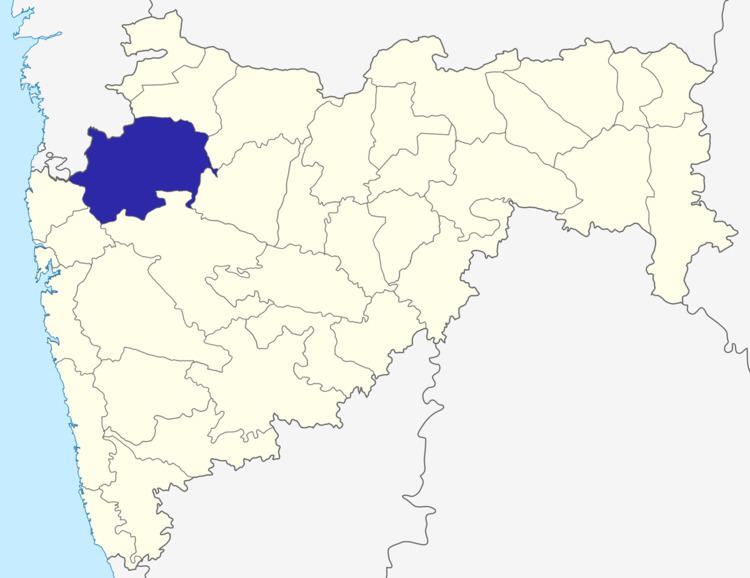
- Map of Nashik Maharashtra
- History
- Geology
- Geography
- Climate
- Demographics
- Languages
- Divisions
- Notable towns
- Places of interest
- References
Map of Nashik, Maharashtra
Nashik district is the third largest district in Maharashtra in terms of area occupying an area of 15,582 square kilometres in the [[NORTH MAHARASHTRA ]] region. It is bounded by Dhule district to the north, Jalgaon district to the east, Aurangabad district to the southeast, Ahmadnagar district to the south, Thane district to the southwest, Valsad and Navsari districts of Gujarat to the west, and The Dangs district to the northwest.
The Western Ghats or Sahyadri range stretches from north to south across the western portion of the district. With the exception of the westernmost few villages, the western portion is hilly, and intersected by ravines, and only the simplest kind of cultivation is possible. The western slope of the Ghats is drained by several rivers, including the Daman Ganga River, which drains westwards to the Arabian Sea.
The larger eastern portion of the district, which lies on the Deccan Plateau, is open, fertile, and well cultivated. The Satmala-Chandwad Range, which runs east and west, forms the chief divide of the plateau region. Peninsular India's largest river Godavari originates in the district in the Trimbakeshwar Range and continues its soujourn eastwards through the district. The Satmala-Chandwad Range forms a watershed, such that, the rivers emerging to its south drain into the Godavari. These include the Kadva and Darna both of which are tributaries of the Godavari. To the north of the Satmala-Chandwad Range, the Girna River and its tributary, the Mosam, flow eastward through fertile valleys into the Tapti River.
History
In the 18th century, the present-day Nashik district was part of the Maratha Confederacy, within the territory controlled directly by the Maratha Peshwa. The district contains several old hill forts, the scenes of many engagements during the Anglo-Maratha Wars. The district became British territory in 1818 on the overthrow of the Peshwa. The present-day district was initially divided between Kandesh and Ahmadnagar districts of Bombay Presidency, a province of British India. Nashik district was created in 1869. The population in 1901 was 816,504, showing a decrease of 3% in the decade 1891-1901. The principal crops were millet, wheat, pulse, oil-seeds, cotton and sugar cane. There were also some vineyards, and much garden cultivation. Yeola was an important centre for weaving silk and cotton goods. There were flour-mills at Malegaon, railway workshops at Manmad and Igatpuri, and cantonments at Deolali and Malegaon. At Sharanpur was a Christian village, with an orphanage of the Church Missionary Society, founded in 1854. In 1861 the main northeast line of the Great Indian Peninsula Railway was completed across the district, and in 1878 a chord line was completed between Manmad, on the northeast line in Nashik district, and Daund, on the southeast line in Pune district. From India's independence in 1947 up to 1960, Nashik district was part of Bombay State, which split into the states of Maharashtra and Gujarat.
Geology
The entire Nashik district is underlain by the basaltic lava flows. These flows are normally horizontally disposed over a wide stretch and give rise to table land type of topography also known a plateau. These flows occur in layered sequences and represented by massive unit at the bottom and vesicular unit at the top of the flow.The shallow alluvial formation of recent age also occurs as narrow stretch along the banks of Godavari Rivers.The soils are the weathering products of Basalt and have various shades from gray to black, red and pink colour.
Geography
Nashik District is a noted for the mountains and hills occupying the north and north-east of its territory.These hill ranges are eastward spurs of the Western Ghats and form prominent landmarks in the district, some noted for the shrines they harbor while others for the trekking adventures which can be undertaken while ascending the peaks. Broadly categorized, the hills can be segregated into 3 noteworthy ranges:
Climate
Extremes: max 42.4 °C (108.3 °F) on May 12, 1960, at Nasik. The lowest, also at Nasik, was 0.6 °C (33.1 °F) on January 7, 1945.
Demographics
According to the 2011 census Nashik district has a population of 6,109,052, roughly equal to the nation of El Salvador or the US state of Missouri. This gives it a ranking of 11th in India (out of a total of 640). The district has a population density of 393 inhabitants per square kilometre (1,020/sq mi) . Its population growth rate over the decade 2001-2011 was 22.33%. Nashik has a sex ratio of 931 females for every 1000 males, and a literacy rate of 80.96%.
The district is 75.64% urban as of 2007.
Languages
Marathi is the official and main language spoken. Various dialects are spoken in smaller parts of northern district that include Ahirani and Bhili. With religious places like Nashik, Trimbakeshwar, ancient Indian language Sanskrit is spoken and widely understood.
Divisions
Administratively, the district is divided into fifteen talukas, which are grouped into four sub-divisions:
Notable towns
Sinnar, a taluka, is one the prime city nashik is looking forward. India's one of big SEZ project is under development in Sinnar. Public service sector like Central bus stop, municipality offices, Setu offices are few of the major ornaments of this city.
Places of interest
The Nashik-Trimbakeshwar Simhastha (Kumbha Mela) is held after every twelve years at Nashik.