
Airport type Public Elevation AMSL 17 ft / 5 m 3,248 990 Elevation 5 m | 16/34 3,248 Code WNA Phone +1 907-266-1735 | |
 | ||
Owner State of Alaska DOT&PF - Central Region Address Yukon Delta National Wildlife Refuge, Napakiak, AK 99634, USA Similar Napaskiak Airport‑Pka, Transport Departme, Alaska State‑Pub Defender, Motor Vehicle Departme, Alaska USA FCU | ||
Napakiak Airport (IATA: WNA, ICAO: PANA, FAA LID: WNA) is a state-owned, public-use airport located in Napakiak, a city in the Bethel Census Area of the U.S. state of Alaska.
As per Federal Aviation Administration records, Napakiak Airport had 1,840 passenger boardings (enplanements) in calendar year 2008, an increase of 0.7% from the 1,828 enplanements in 2007. Napakiak Airport is included in the FAA's National Plan of Integrated Airport Systems (2009–2013), which categorizes it as a general aviation facility.
Facilities
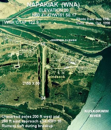
Napakiak Airport has one runway designated 16/34 with a gravel surface measuring 3,248 by 60 feet (990 x 18 m). The airport is unattended.
Remarks:
References
Napakiak Airport Wikipedia(Text) CC BY-SA