
Original number of locks 238 Date completed 1836 Start point Brest | Total rise 555 m (1,821 ft) End point Nantes Locks 238 | |
 | ||
Length 385 km (239 mi) original length Status Open except for two breaks; Goariva to La Pitié, Guerlédan Dam to Pontivy Original owner Napoleon in 1811. Canal Company of Brittany in 1822. Construction began 1811 start failed and began again in 1822 Similar Lake Guerlédan, Oust, Abbaye Notre‑Dame de Bon‑R, Monts d'Arrée, Dam of Guerlédan | ||
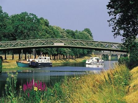
The Nantes-Brest canal (Canal de Nantes à Brest) is a French canal which links the two cities of Nantes and Brest through inland Brittany. It was built during the 19th century and its total length is 385 km with 238 locks from coast to coast. The western portion of the canal is also known as Branche Finistèrienne.
Contents
Map of Nantes-Brest canal, 29150, France
HistoryEdit
The original idea of such a canal is dated from the 16th century but it's only when Brest was blockaded by the English fleet that Napoleon I of France decided to build this canal to assure a safe inland link between the two largest military ports of the French Atlantic front. Building started in 1811, and Napoleon III of France presided over the canal's opening in 1858.
In 1923 the route of the canal was broken by the Guerledan dam. Navigation is no longer possible between Maël-Carhaix and Pontivy. The lake flooded the uppermost portion of the canal for some 8 km along with 17 locks.
En RouteEdit
The canal utilizes the following rivers, west to east:
Break at Lake Guerlédan
Total length on this current route is 337 km and 158 locks.
West to East Beginning in Brest on the canalized portion of the Aulne River for 51 km via 8 locks.
Continuing on Aulne, now called Canal de Nantes à Brest(Ouest) (English: West) for 81 km via 45 locks.
Lake Guerlédan halts the canal until Pontivy.
Canal de Nantes à Brest(Est) (English: East) Pontivy to Nantes 205 km via 105 locks